Saint-Jean-du-Bruel
Wygląd
Na mapach:  44°01′N 3°22′E/44,016667 3,366667
| miejscowość i gmina | |||

| |||
| |||
| Państwo | |||
|---|---|---|---|
| Region | |||
| Departament | |||
| Okręg | |||
| Kod INSEE |
12231 | ||
| Powierzchnia |
37,27 km² | ||
| Populacja (2013) • liczba ludności |
| ||
| Kod pocztowy |
12230 | ||
Położenie na mapie Francji  | |||
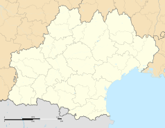
Położenie na mapie Oksytanii  | |||
Położenie na mapie Aveyron  | |||
| Strona internetowa | |||
Saint-Jean-du-Bruel – miejscowość i gmina we Francji, w regionie Oksytania, w departamencie Aveyron[1]. W 2013 roku jej populacja wynosiła 659 mieszkańców[2]. Gmina położona jest na terenie Parku Regionalnego Grands Causses[3].
Przypisy
[edytuj | edytuj kod]- ↑ Atlas Routier France 2014. Michelin, s. 282. ISBN 978-2-06-719261-4. (fr.).
- ↑ Populations légales 2013. INSEE. [dostęp 2017-07-12]. (fr.).
- ↑ Les communes du Parc naturel régional des Grands Causses. annuaire-mairie.fr. [dostęp 2017-07-26]. (fr.).

