Gori, Georgie
Gori გორი | |
|---|---|
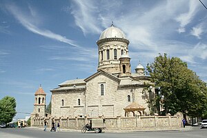
 Georgian Orthodox Cathedral in Gori | |
| Coordinates: 41°58′0″N 44°06′0″E / 41.96667°N 44.10000°E | |
| Kintra | Georgie |
| Region | Shida Kartli |
| Elevation | 588 m (1,929 ft) |
| Population (2014) | |
| • Total | 48,143 |
| Time zone | UTC+4 (Georgie Time) |
| Website | http://www.gori-municipality.ge |
Gori (Georgie: გორი) is a ceety in eastren Georgie, which serves as the regional caipital o Shida Kartli an the centre o the homonymous admeenistrative destrict. The name is frae Georgie gora (გორა), that is, "heap", or "hill".[1] As o 2014, it haed a population o 48,143.
Gori wis a important militar stranghauld in the Middle Ages an maintains a strategic importance due tae its location on the principal heich-gate connectin eastren an wastren pairts o Georgie. In the course o its history, Gori haes been invadit bi the airmies o regional pouers several times. The ceety wis occupeed bi Roushie troops durin the Roushie-Georgie War.
Gori is kent as the birthplace o the Soviet leader Joseph Stalin an ballistic missile designer Alexander Nadiradze an aw.
Geografie an climate
Gori is locatit 76 kilometre (47 mi)* wast o Georgie's caipital Tbilisi, at the confluence o the rivers Mtkvari an Greater Liakhvi, 588 metre (1,929 ft)* abuin sea level. The climate is transitional frae moderately warm steppe tae moderately humid. Simmer is uisually hot. The average annual temperatur is 10.9 °C (51.6 °F), minimal in Januar (−1.2 °C (29.8 °F)*) an maximal in August (22.5 °C (72.5 °F)*). The maximum precipitation faws in Mey (76 mm (3.0 in)*) an minimum in August (34 mm (1.3 in)*) an Januar (30 mm (1.2 in)*).
References
- ↑ E.M. Pospelov, Geograficheskie nazvaniya mira (Moscow, 1998), p. 121.
Freemit airtins
| Wikimedia Commons haes media relatit tae Gori, Georgie. |
- Offeecial Steid Archived 2011-11-11 at the Wayback Machine
- Map o Gori Archived 2011-08-20 at the Wayback Machine
- On Gori, Georgie
- Live WebCam Gori Archived 2012-03-05 at the Wayback Machine


