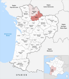
Arrondissement of Montmorillon
Montmorillon | |
|---|---|
 Location within the region Nouvelle-Aquitaine | |
| Country | France |
| Region | Nouvelle-Aquitaine |
| Department | Vienne |
| No. of communes | 91 |
| Subprefecture | Montmorillon |
| Area | 2,876.1 km2 (1,110.5 sq mi) |
| Population (Jan. 2019)[1] | 66,518 |
| INSEE code | 862 |
The arrondissement of Montmorillon is an arrondissement of France, in the Vienne department, Nouvelle-Aquitaine region. Its capital is the city of Montmorillon.
History
[change | change source]When the Vienne department was created on 1800, the arrondissement of Montmorillon was part of that original department.[2]
Geography
[change | change source]The arrondissement of Montmorillon is in southern Vienne and is bordered to the north by the other two arrondissements of the departmentː Poitiers to the nortwest and Châtellerault to the northeast. The arrondissement is also surrounded by the Indre department to the east, the Haute-Vienne department to the southeast, the Charente to the south and the Deux-Sèvres department to the west.
It has an area of 2,998.8 km2 (1,157.8 sq mi).[3] It has 74,852 inhabitants and a density of 25.0 inhabitants/km².[4] It is the arrondissement of Vienne with fewest people in it but is the one with the largest area.
Composition
[change | change source]Cantons
[change | change source]After the reorganisation of the cantons in France,[5] cantons are not subdivisions of the arrondissements so they could have communes that belong to different arrondissements.
In the arrondissement of Montmorillon, there are 2 cantons whose communes are in the arrondissement: Civray and Lussac-les-Châteaux. The following table shows the distribution of the "communes" in the cantons and arrondissements:
| INSEE Code |
Canton | Arrondissements | Total | ||
|---|---|---|---|---|---|
| Châtellerault | Montmorillon | Poitiers | |||
| 8605 | Chauvigny | 7 | 8 | 15 | |
| 8606 | Civray | 30 | 30 | ||
| 8609 | Lusignan | 10 | 9 | 19 | |
| 8610 | Lussac-les-Châteaux | 25 | 25 | ||
| 8612 | Montmorillon | 1 | 25 | 26 | |
Communes
[change | change source]The arrondissement of Montmorillon has 95 communes; they are (with their INSEE codes)ː[6]
- Adriers (86001)
- Anché (86003)
- Antigny (86006)
- Asnières-sur-Blour (86011)
- Asnois (86012)
- Availles-Limouzine (86015)
- Béthines (86025)
- Blanzay (86029)
- Bouresse (86034)
- Bourg-Archambault (86035)
- Brigueil-le-Chantre (86037)
- Brion (86038)
- Brux (86039)
- La Bussière (86040)
- Ceaux-en-Couhé (86043)
- Champagné-le-Sec (86051)
- Champagné-Saint-Hilaire (86052)
- Champniers (86054)
- La Chapelle-Bâton (86055)
- Chapelle-Viviers (86059)
- Charroux (86061)
- Chatain (86063)
- Château-Garnier (86064)
- Châtillon (86067)
- Chaunay (86068)
- Civaux (86077)
- Civray (86078)
- Couhé (86082)
- Coulonges (86084)
- La Ferrière-Airoux (86097)
- Fleix (86098)
- Gençay (86103)
- Genouillé (86104)
- Gouex (86107)
- Haims (86110)
- L'Isle-Jourdain (86112)
- Jouhet (86117)
- Journet (86118)
- Joussé (86119)
- Lathus-Saint-Rémy (86120)
- Lauthiers (86122)
- Leignes-sur-Fontaine (86126)
- Lhommaizé (86131)
- Liglet (86132)
- Linazay (86134)
- Lizant (86136)
- Luchapt (86138)
- Lussac-les-Châteaux (86140)
- Magné (86141)
- Mauprévoir (86152)
- Mazerolles (86153)
- Millac (86159)
- Montmorillon (86165)
- Moulismes (86170)
- Moussac (86171)
- Mouterre-sur-Blourde (86172)
- Nalliers (86175)
- Nérignac (86176)
- Paizay-le-Sec (86187)
- Payré (86188)
- Payroux (86189)
- Persac (86190)
- Pindray (86191)
- Plaisance (86192)
- Pressac (86200)
- Queaux (86203)
- Romagne (86211)
- Saint-Gaudent (86220)
- Saint-Germain (86223)
- Saint-Laurent-de-Jourdes (86228)
- Saint-Léomer (86230)
- Saint-Macoux (86231)
- Valdivienne (86233)
- Saint-Martin-l'Ars (86234)
- Saint-Maurice-la-Clouère (86235)
- Saint-Pierre-de-Maillé (86236)
- Saint-Pierre-d'Exideuil (86237)
- Saint-Romain (86242)
- Saint-Savin (86246)
- Saint-Saviol (86247)
- Saint-Secondin (86248)
- Saulgé (86254)
- Savigné (86255)
- Sillars (86262)
- Sommières-du-Clain (86264)
- Surin (86266)
- Thollet (86270)
- La Trimouille (86273)
- Usson-du-Poitou (86276)
- Vaux (86278)
- Verrières (86285)
- Le Vigeant (86289)
- Villemort (86291)
- Voulême (86295)
- Voulon (86296)
Related pages
[change | change source]References
[change | change source]- ↑ "Téléchargement du fichier d'ensemble des populations légales en 2019". The National Institute of Statistics and Economic Studies. 28 December 2020.
- ↑ "Historique de la Vienne". Le SPLAF (in French). Retrieved 29 July 2016.
- ↑ "Arrondissement de Montmorillon (862)". Comparateur de territoire (in French). Institut national de la statistique et des études économiques - INSEE. Retrieved 15 April 2017.
- ↑ "Régions, départements, arrondissements, cantons et communes" (PDF). Populations légales 2014 (in French). Institut national de la statistique et des études économiques - INSEE. Retrieved 4 April 2017.
- ↑ "Décret n° 2014-264 du 26 février 2014 portant délimitation des cantons dans le département de la Vienne" (in French). Legifrance. Retrieved 15 April 2017.
- ↑ "Arrondissement de Montmorillon (862)". Géographie administrative et d'étude (in French). Institut national de la statistique et des études économiques - INSEE. Retrieved 15 April 2017.
