Lörrach
Appearance
Lörrach | |
|---|---|
 Aerial view at Lörrach from the north | |
| Coordinates: 47°37′N 7°40′E / 47.617°N 7.667°E | |
| Country | Germany |
| State | Baden-Württemberg |
| Admin. region | Freiburg |
| District | Lörrach |
| Government | |
| • Mayor | Jörg Lutz |
| Area | |
| • Total | 39.43 km2 (15.22 sq mi) |
| Elevation | 294 m (965 ft) |
| Population (2022-12-31)[1] | |
| • Total | 49,876 |
| • Density | 1,300/km2 (3,300/sq mi) |
| Time zone | UTC+01:00 (CET) |
| • Summer (DST) | UTC+02:00 (CEST) |
| Postal codes | 79501-79541 |
| Dialling codes | (+49) 07621 |
| Vehicle registration | LÖ |
| Website | www |
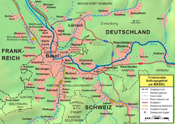
Lörrach is a town in southwest Germany, in the valley of the Wiese. It is close to the French and the Swiss borders. It is the capital of the district of Lörrach in Baden-Württemberg. The city had a population of 10,794 in 1905 and of 47,707 in 2007.
It is the hometown of Ottmar Hitzfeld, one of the most successful and popular football managers in Germany.
References
[change | change source]- ↑ "Bevölkerung nach Nationalität und Geschlecht am 31. Dezember 2022" [Population by nationality and sex as of December 31, 2022] (CSV) (in German). Statistisches Landesamt Baden-Württemberg. June 2023.
- ↑ "Annual area and population data for Lörrach". Statistisches Landesamt Baden-Württemburg (in German). Archived from the original on 2013-07-23. Retrieved 2008-01-21.
Other websites
[change | change source]![]() Media related to Lörrach at Wikimedia Commons
Media related to Lörrach at Wikimedia Commons
Wikivoyage has a travel guide about: Lörrach
- Official website (in German)
- (in German) Lörrach:History and images Archived 2012-12-11 at Archive.today
- Lörrach Civic Heraldry
- Daily Newspaper of the area
- Daily Newspaper of the area[permanent dead link]
- News and musings from Weil am Rhein - German town near Loerrach on the Basle border triangle
- Burg Rötteln: Picture Gallery Archived 2018-12-21 at the Wayback Machine
- Burghof Cultural Event Centre and Theatre
- Cultural Youth events in Loerrach
- 'Stimmen' Loerrach
- 'Metal Forces Festival' Loerrach


