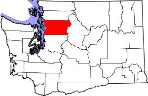
Snohomish County, Washington
Appearance
Snohomish County | |
|---|---|
 Aerial view of the Snohomish River delta, including portions of Everett, Lake Stevens, and Marysville | |
 Location within the U.S. state of Washington | |
 Washington's location within the U.S. | |
| Coordinates: 48°02′N 121°43′W / 48.04°N 121.71°W | |
| Country | |
| State | |
| Founded | January 14, 1861 |
| Named for | the Snohomish people |
| Seat | Everett |
| Largest city | Everett |
| Area | |
| • Total | 2,196 sq mi (5,690 km2) |
| • Land | 2,087 sq mi (5,410 km2) |
| • Water | 109 sq mi (280 km2) 5.0% |
| Population (2020) | |
| • Total | 827,957 |
| • Density | 384/sq mi (148/km2) |
| Time zone | UTC−8 (Pacific) |
| • Summer (DST) | UTC−7 (PDT) |
| Area code | 206, 360, 425, 564 |
| Congressional districts | 1st, 2nd, 8th |
| Website | snohomishcountywa |
Snohomish County is a county in the U.S. state of Washington. As of 2020, its population was 827,957.[1] The county seat is Everett.[2]
References
[change | change source]- ↑ "QuickFacts: Snohomish County, Washington". United States Census Bureau. Retrieved January 20, 2024.
- ↑ National Association of Counties. "NACo County Explorer". Retrieved January 20, 2024.


