Iwakura
Utseende
| Iwakura ( | |
| Stad | |
| Land | |
|---|---|
| Region | Chūbu (Tōkai) |
| Prefektur | Aichi |
| Ö | Honshū |
| Koordinater | 35°16′46″N 136°52′17″Ö / 35.27944°N 136.87139°Ö |
| Area | 10,47 km²[1] |
| Folkmängd | 47 563 (1 okt 2015)[1] |
| Befolkningstäthet | 4 543 invånare/km² |
| Geonames | 1861207 |
| Träd | Kamferträd |
| Blomma | Azalea |
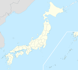
 Iwakuras läge i Japan
| |
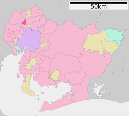
 Städer: Signifikanta städer Övriga städer Landskommuner: Köpingar Byar Iwakuras läge i Aichi prefektur
Städer: Signifikanta städer Övriga städer Landskommuner: Köpingar Byar | |
| Webbplats: Iwakuras officiella webbplats | |
Iwakura (
Källor
[redigera | redigera wikitext]- ^ [a b c] ”
市区 町村 プロフィール (Kommunprofiler)” (på japanska). Masahiro Higashide. http://uub.jp/cpf/aichi.html. Läst 15 oktober 2016. - ^ Publikation 2005 Population Census of Japan, Overview Series No.9; Population of Major Metropolitan Areas, Statistics Bureau, Ministry of Internal Affairs and Communications, Japan; ISBN 978-4-8223-3577-9.
 Wikimedia Commons har media som rör Iwakura.

