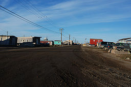
North Slope Borough
Utseende
| North Slope Borough | |
| County | |
Barrow
| |
| Land | |
|---|---|
| Delstat | |
| Huvudort | Barrow |
| Area | 245 521 km² (2010)[1] |
| - land | 229 720 km² (94%) |
| - vatten | 15 801 km² (6%) |
| Folkmängd | 9 430 (2010)[2] |
| Befolkningstäthet | 0 invånare/km² |
| Grundat | 1972 |
| Tidszon | AKST (UTC-9) |
| - sommartid | AKDT (UTC-8) |
| FIPS-kod | 02185 |
| Geonames | 5870308 |
 Läge i delstaten Alaska.
| |
|
Delstatens läge i USA.
| |
| Webbplats: http://www.north-slope.org | |
| Fotnoter: Naco - Find a county | |
North Slope Borough är en borough i den amerikanska delstaten Alaska. Dess säte är Barrow. Enligt 2000 års folkräkning hade boroughen en befolkning på 9 430 invånare på en yta om 245 436 km².
Delar av Gates of the Arctic nationalpark och Arctic National Wildlife Refuge ligger i North Slope Borough.
Geografi
[redigera | redigera wikitext]Matanuska-Susitna Borough gränsar till Yukon-Koyukuk Census Area i sydöst och Northwest Arctic Borough i sydväst. I öst gränsar den näta Demarcation Bay till Yukon i Kanada.
Städer och byar
[redigera | redigera wikitext]- Anaktuvuk Pass
- Atqasuk
- Barrow
- Kaktovik
- Nuiqsut
- Point Hope
- Point Lay
- Prudhoe Bay
- Wainwright
- Deadhorse
Källor
[redigera | redigera wikitext]- ^ ”2010 Census U.S. Gazetteer Files for Counties”. U.S. Census Bureau. Arkiverad från originalet den 5 juli 2012. https://www.webcitation.org/68vYLbou5?url=http://www.census.gov/geo/www/gazetteer/files/Gaz_counties_national.txt. Läst 5 juli 2012.
- ^ ”State & County QuickFacts, North Slope Borough, Alaska” (på engelska). U.S. Census Bureau. Arkiverad från originalet den 15 juli 2011. https://www.webcitation.org/60CPm4dvq?url=http://quickfacts.census.gov/qfd/states/02/02185.html. Läst 6 juli 2011.
Externa länkar
[redigera | redigera wikitext] Wikimedia Commons har media som rör North Slope Borough.
| ||||||||||


