Tōkamachi
Utseende
| Tōkamachi ( | |
| Stad | |
| Land | |
|---|---|
| Region | Chūbu (Hokuriku) |
| Prefektur | Niigata |
| Ö | Honshū |
| Koordinater | 37°7′39″N 139°45′21″Ö / 37.12750°N 139.75583°Ö |
| Area | 590,39 km²[1] |
| Folkmängd | 54 932 (1 okt 2015)[1] |
| Befolkningstäthet | 93 invånare/km² |
| Geonames | 1850217 |
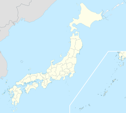
 Tōkamachis läge i Japan
| |
|
Tōkamachis läge i Niigata prefektur
| |
| Webbplats: http://www.city.tokamachi.lg.jp/ | |
Tōkamachi (japanska:
Källor
[redigera | redigera wikitext]- ^ [a b c] ”
市区 町村 プロフィール (Kommunprofiler)” (på japanska). Masahiro Higashide. http://uub.jp/cpf/niigata.html. Läst 8 oktober 2016.
|

