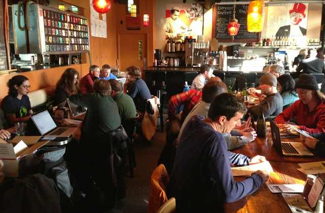
Mapathon
A Mapathon is a coordinated mapping event. It is often held inside (armchair mapping) but can also be an outside or combined activity.
The page on Universities includes institutions that have had or have active OSM communities that may be willing to collaborate with future mapathon activities.
How to Host a Mapathon
Source material comes from the Missing Maps[1] initiative which includes details on how to plan the logistics and details of a mapathon event.
Planning Checklist
Have you thought about the following components?:
- Choosing a date
- Recruiting volunteers to help with event
- 3rd party planning tools (such as eventbrite) to register and recruit more volunteers
- Specific goals (eg. using tasking manager from hotosm
- Theme of the mapping event
- Strong internet/wifi signals
- If using tasking manager, making sure it passes local internet system firewall
- Sufficient and accommodating seating and tables
- Projector & audio visual equipment
- Computers or laptops for all participants
- Computer mice for all participants
- Contact info for rented tech and support staff
- Extra extension cords
- Print materials ready
- Snacks and related materials (napkins, plates, etc.)
Event Day Checklist
- Set-up room
- Test internet/wifi and tasking manager for various OS (such as windows and apple) and browsing applications
- Tape down extension cords
- Set up registration table
- Lay out printed materials
- Prepare presentations
- Set up snacks
- Ensure fun atmosphere!
Peru Mapathons
Openstreetmap Perú organized some mapathons:
- Mapping of hamlets of the Federation of native communities of the Ucayali and tributaries FECONAU
- Mapping of archaelogical site Mateo Salado
- Mapathon CONIDA 2023
US Mapathons
OpenStreetMap US calls quarterly mapathons, held in various cities on the same weekend, all focused on improving the US map (more on mapathons in the US):
- US Spring Editathon 2013
- US Summer Editathon 2013
- US Fall Editathon 2013
- US Winter Editathon 2014
- US Spring Editathon 2014
- US Summer Mapathon 2014 - also the 10th Anniversary party!
- Mapathon/OSM Geo Week 2014 - start of Geography Awareness Week!
- Mapathon/US Winter Mapathon 2015
- Mapathon/US Spring Mapathon 2015
- Mapathon/US Summer Mapathon 2015
- Mapathon/US Autumn Mapathon 2015
- Mapathon/US Winter Mapathon 2016
- Mapathon/US Spring Mapathon 2016
- Mapathon/US Summer Mapathon 2016
- US Spring Mapathon 2017
- Mapathon/US Summer Mapathon 2017
- Mapathon/US Fall Mapathon 2017
- Mapathon/US_Fall_Mapathon_2018
The hashtag #mapathon (previously #editathon) is used on every changeset committed during a Mapathon event. This way, we can keep track of how much progress was made.
See also
References
- ↑ “Missing Maps.” Www.Missingmaps.Org, www.missingmaps.org/host/. Accessed 9 Oct. 2020.
