Landslides
BGS Research
BGS hosts one of the largest concentrations of landslide experts in the UK. Our researchers are involved in many aspects of landslide research with the primary objective of building resilience both in the UK and internationally. This research is funded through commercial, grant funded and public science role projects and is published in reports, web pages and peer-reviewed publications.
Current projects
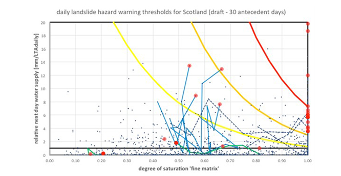
Trigger threshold values (TTVs) are measurements of the process intensities that drive a geohazard. For example, this might be the magnitude of an earthquake that triggers landslides in areas of earthquake-induced landsliding.
Earthquake-triggered landslides are relatively rare in the UK, where the key trigger for landsliding is rainfall. Determining the TTV for rainfall-induced landslides is challenging because the TTV varies with the type of soil, which may bring forth the effect of antecedent conditions, i.e. the soil moisture conditions prior to an event.
TTVs also vary with rainfall intensity. Our researchers investigate TTVs in a variety of ways that primarily reflect data availability:
- analysis of historic landslide events in the context of the associated weather conditions (antecedent and event-day precipitation) leading to the event trigger
- statistical methods are applied at a range of scales. At a coarse level, we provide a monthly analysis of landslides and rainfall
- deterministic analyses of antecedent soil moisture conditions considering soil properties (porosity; saturated coefficient of permeability; soil water characteristics curve) in the context of observed and forecasted meteorological conditions
- analysis of analogues for soil moisture, such as electrical resistivity (e.g. PRIME) and meteorological conditions
© BGS/UKRI.
We are carrying out ongoing landslide susceptibility research at higher resolutions and in the context of specific styles of landsliding.
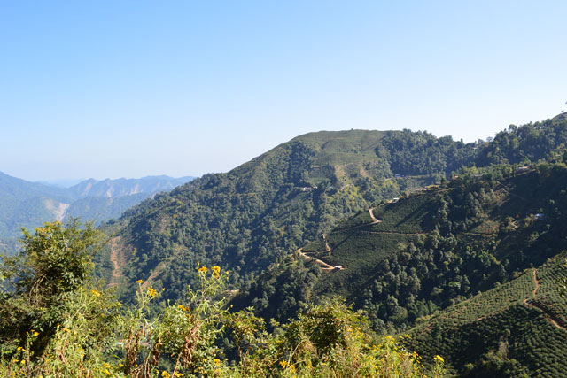
LANDSLIP is funded by the UK Natural Environment Research Council (NERC) and the Department for International Development (DFID) Science for Humanitarian Emergencies and Resilience programme, which aims to support improved disaster resilience and humanitarian response by advancing monitoring, assessment and modelling for the prediction of natural hazards and risks in India.
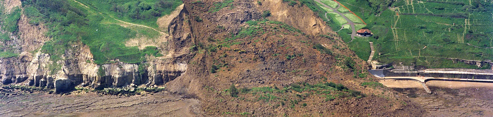
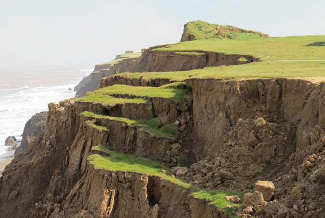
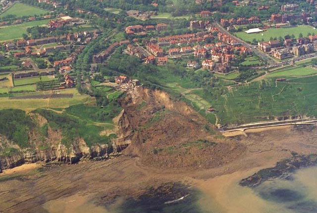
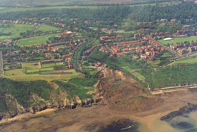
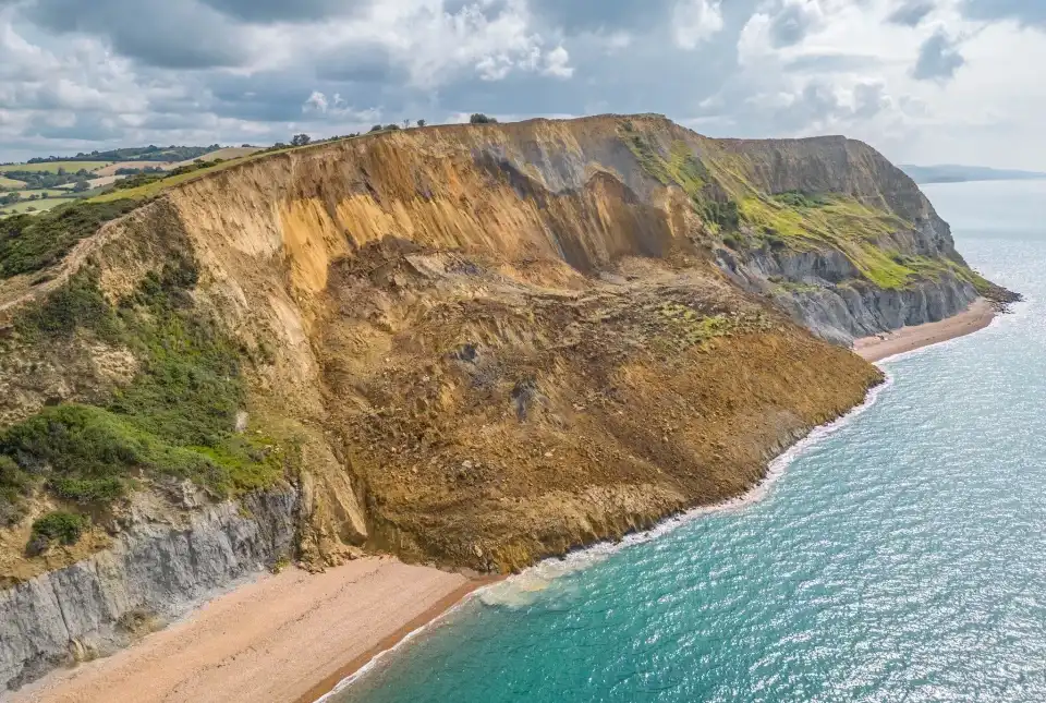
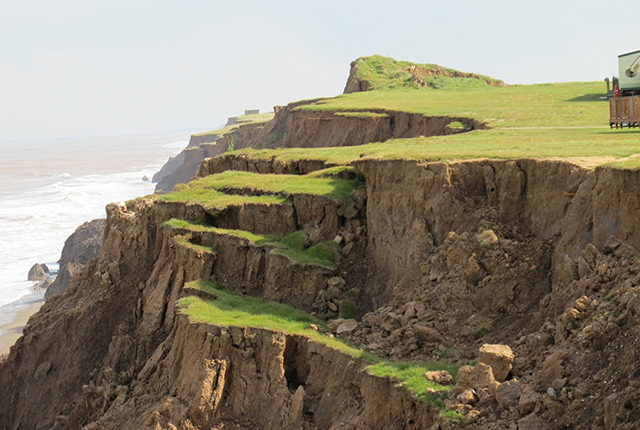
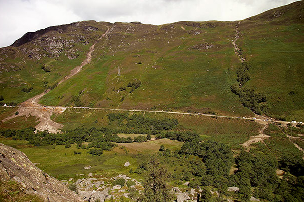
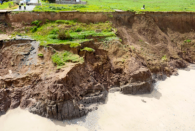
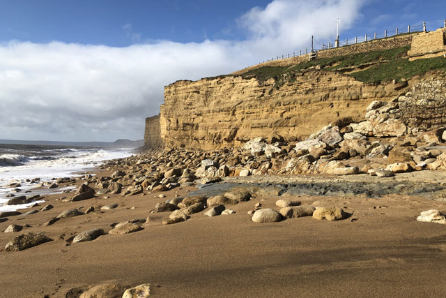
This research is focused on the landslide processes associated with coastal erosion and it is focused on coastal landslide observatories, including Aldbrough in Yorkshire.
Our hazard and resilience modellers use a range of techniques that reflect the scale of modelling (national to site scale), the style of landslides and the availability of data. Methods include heuristic, statistical and deterministic approaches. Susceptibility and impact modelling is largely GIS hosted and is ultimately aimed at risk minimisation and resilience building.
For more information please contact Vanessa Banks.
Report a landslide
Please tell us about any British landslides you may have seen on TV, heard about on the radio, read in newspapers etc.
Landslide assessment report
This report is for people who are carrying out preliminary site assessments or who have a general interest in the landslides of a particular area
Find out more about our research
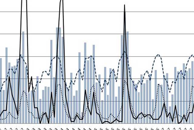
Landslides and rainfall
We combine rainfall statistics and landslide data to produce graphs demonstrating the relationship between landslides and rainfall.
Landslide observatories
BGS have long-term monitoring observatories where data have been collected, in some instances, since 2001.

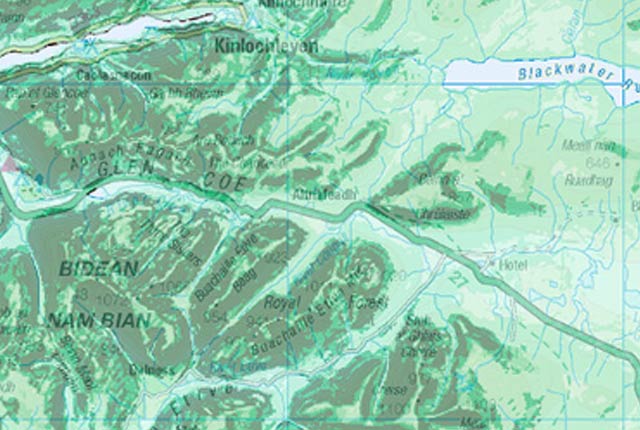
Landslide case studies
The landslides team at the BGS has studied numerous landslides. This work informs our geological maps, memoirs and sheet explanations and provides data for our National Landslide Database, which underpins much of our research.
Hazard and resilience modelling
The hazard and resilience modelling team aims to develop new and innovative data products that deliver geoscientific information to a range of users in an accessible form.
Natural Hazards Partnership
The NHP builds on the interdisciplinary expertise of its partners to deliver better coordinated natural hazards science, research and advice to Governments, Civil Contingency responders and other hazard resilience groups across the UK.
Our projects
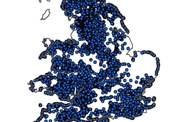
National Landslide Database
The BGS National Landslide Database (NLD) is the most extensive source of information on landslides in Great Britain.
BGS GeoSure: landslides
The potential for landsliding (slope instability) to be a hazard has been assessed using 1:50 000 scale digital maps of superficial and bedrock deposits. These have been combined with information from the BGS National Landslide Database and scientific and engineering reports.
BGS GeoSure: debris flow susceptibility model
The Debris Flow landslide layer provides information on the potential of the ground, at a given location, to form a debris flow. It is based on a combination of digital geological, hydrogeological and topographic data.
Related news
BGS receives award at the World Landslide Forum 2023
30/11/2023
BGS’s landslide team has been designated a World Centre of Excellence on landslide risk reduction by the International Consortium on Landslides.
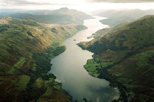
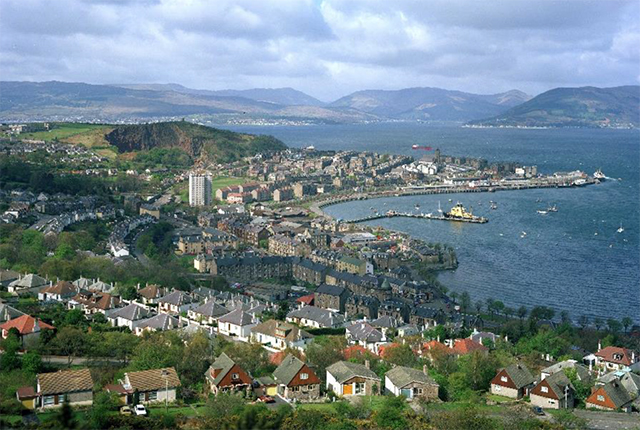
Below the bonnie banks: mapping Loch Lomond’s underwater landslides
07/03/2023
Using high-resolution, multibeam bathymetry and shallow seismic imaging, BGS’s marine geoscience and landslides teams are mapping historic landslides under the waters of Loch Lomond.
Five places in Yorkshire to assess key geological hazards
21/12/2022
A field trip to Yorkshire has helped our data products team improve their output.
Introducing the BGS Debris Flow Susceptibility Model for Great Britain
21/11/2022
Debris flows are a landslide hazard of particular concern to transport infrastructure managers and local authorities.
Citizen science: become part of a real-time Global Landslide Detector
29/08/2022
BGS and partners are trialling a new social media tool that detects worldwide landslides in real time.
Increased risk to the public from rockfalls as a result of the forecasted heatwave
15/07/2022
Take notice of warning signs and avoid going directly under or on top of cliffs, no matter how tempting it might be.
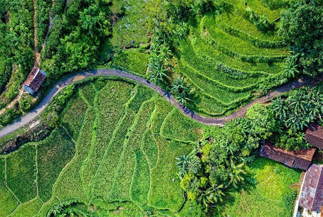
Developing regional-scale landslide forecasting in hazard-prone regions of India
23/06/2022
BGS has been involved in co-developing a prototype regional-scale landslide forecasting system in two hazard-prone districts of India.
Scientists identify hidden landslides beneath Scottish lochs
26/06/2020
Survey data shows five locations around the Scottish coast are subject to underwater landslides.
New tsunami risk identified in Indonesia
30/04/2020
Scientists have identified a potential new tsunami risk in Indonesia by mapping below the seabed of the Makassar Strait.
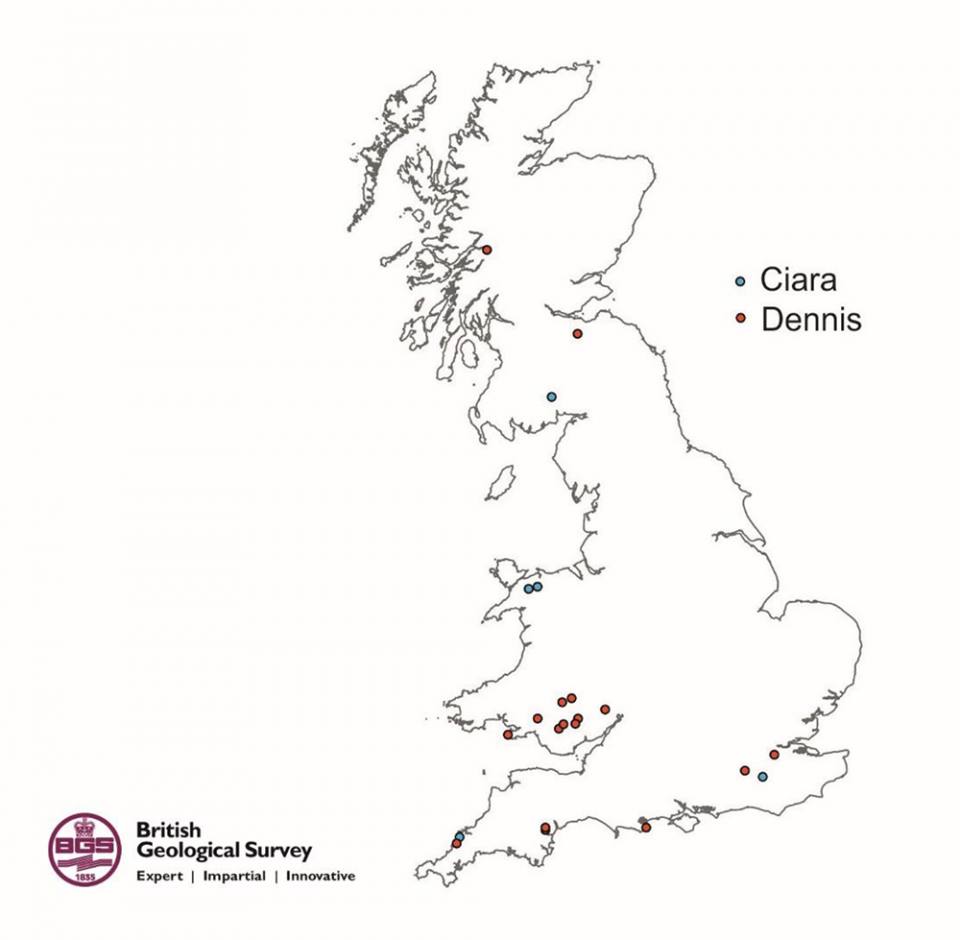
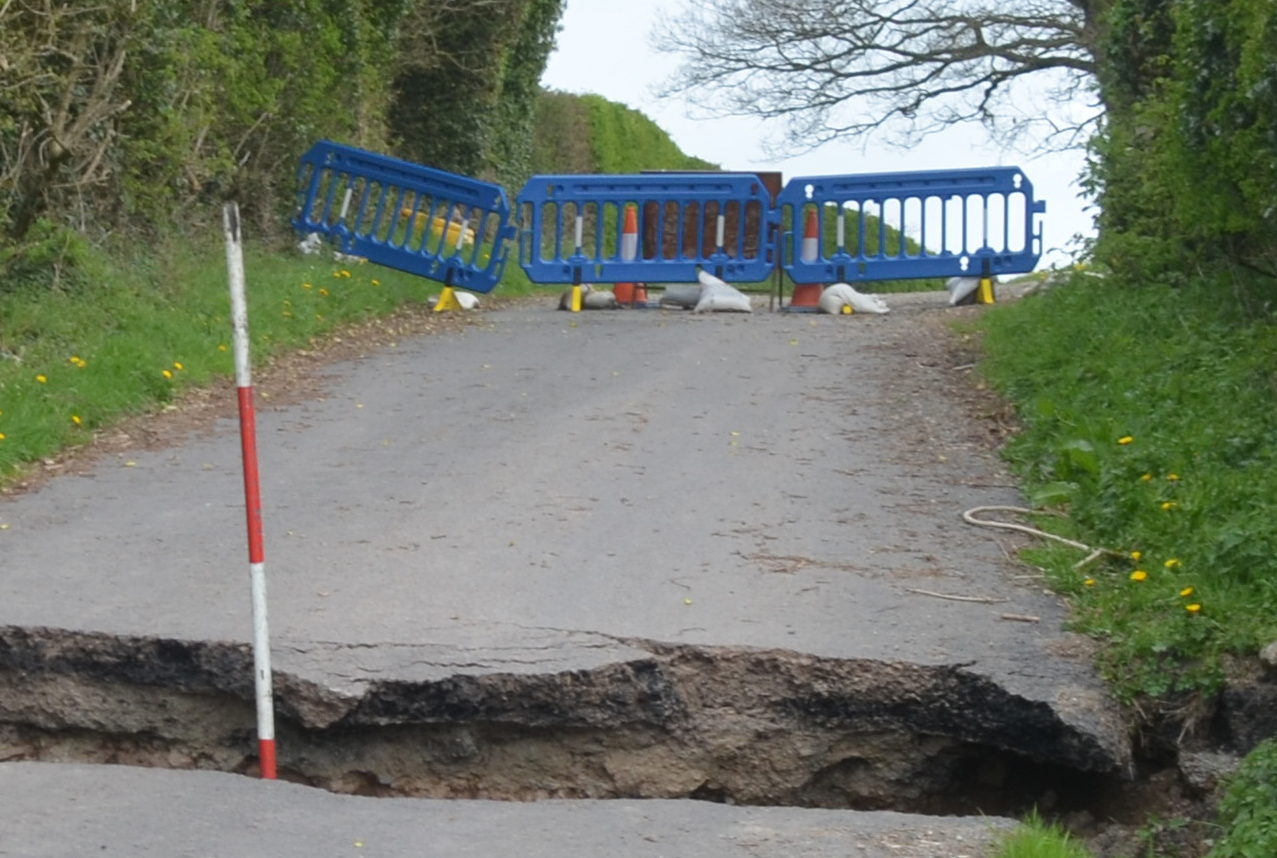
Landslides triggered by Storm Ciara and Storm Dennis in the UK
21/02/2020
On Sunday 9 February 2020, Storm Ciara hit the UK with very high winds and intense rainfall causing widespread disruption and flooding.
You may also be interested in
Shallow geohazards
Measuring, recording and analysing near-surface geological hazards including landslides, sinkholes and discontinuities.
Earthquakes and seismology research
We are measuring, recording and analysing ground motions from earthquakes and other seismic events across the UK and overseas.