GeoIndex offers free, direct, online access to the National Geoscience Data Centre’s (NGDC) collection of over a million onshore scanned boreholes, shafts and well records.

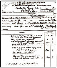
Scanned borehole record. BGS © UKRI.
What is a borehole record?
Boreholes range from one to several thousand metres deep. Borehole records are produced from a geologist’s or surveyor’s observations of the rock core extracted from the ground and typically include locality and lithological descriptions with depth and thickness. Geophysical logs may also be noted from on-site measurements.
National well archive
Searching BGS borehole records also gives you access to the the National Well Record Collection. It contains more than 130 000 classified records of wells, boreholes and springs within England and Wales; a unique database of hydrogeological information.
On-site measurements that may be noted are:
- water level measurements
- geochemistry data


