Department of Earth Sciences
Service Navigation
Animations of Mars, Saturn & co.
On this page we present virtual flights and animations. For the shown sequences image data of current space missions were used. Take also a look at our YouTube-channel FUBPlanetarySciences.


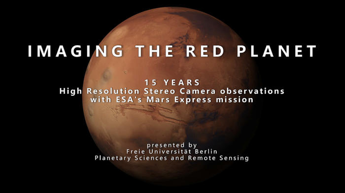
15 Years Imaging Mars
On January 10, 2004, the first of thousands of detailed images of the Martian surface was captured by the High Resolution Stereo Camera.

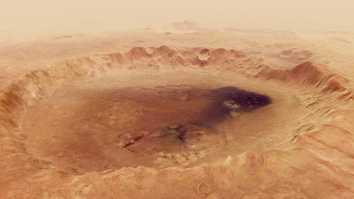
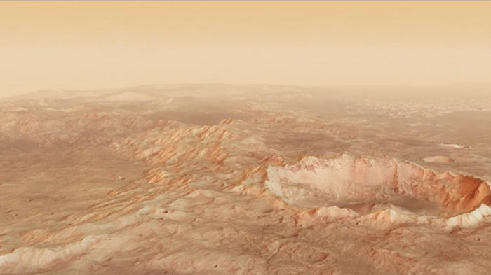
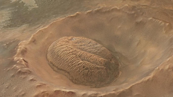
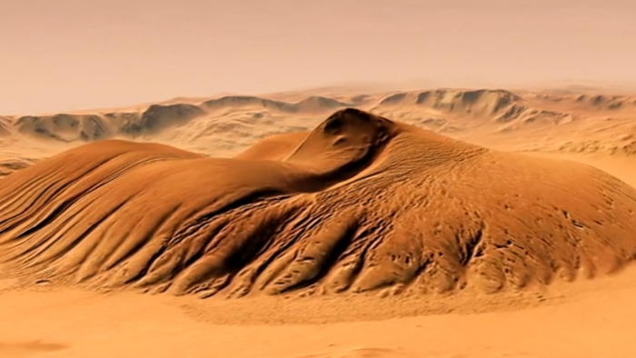
Flight over Neukum Crater
The impact crater Neukum - named after the German planetary scientist Gerhard Neukum - is located in the densely cratered Southern Highlands on Mars.

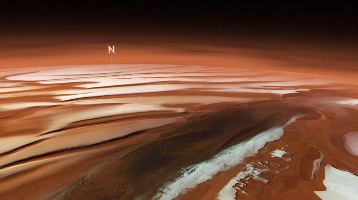
North polar ice cap
The north polar ice cap of Mars appears like a gigantic spiral out of ice and snow. Dark troughs in which dust and deposits accumulated, alternate with white, ice-covered mounds.

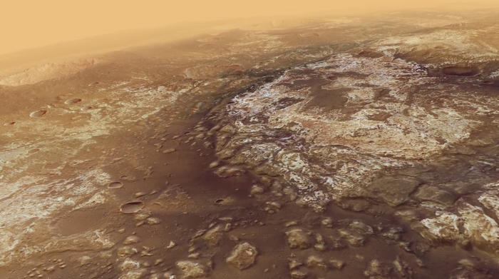
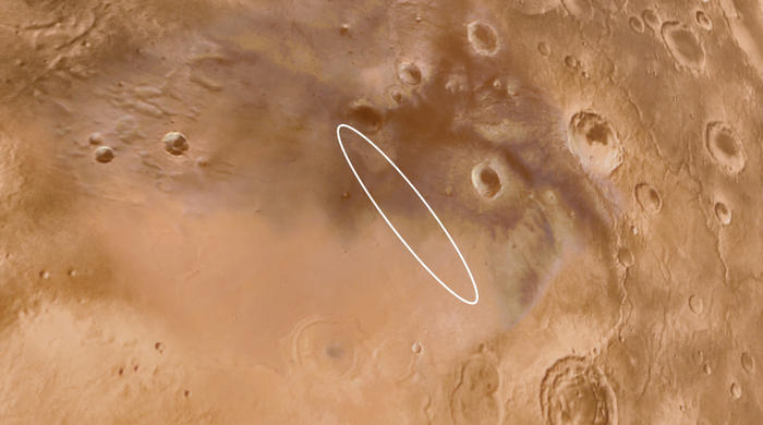
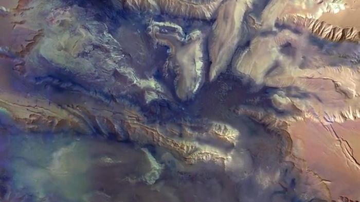
Outflow channel Mawrth Vallis
A candidate landing site for ESA’s mission ExoMars 2020 is the billion years old landscape in Mawrth Vallis, situated at the boundary of the southern highlands.

Schiaparelli landing site
On 14 March 2016 the European Mars mission ExoMars 2016 was launched. The landing module Schiaparelli is scheduled to arrive at Mars in October 2016.

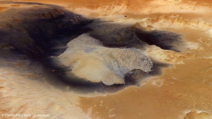
Atlantis Chaos
The Atlantis basin in the southern highlands likely owes its existence to an asteroid impact that took place in the early history of Mars.

Becquerel Crater
This animation features Becquerel crater on our neighbor planet Mars. On the floor of the crater sediments build a pile of nearly 1000 meters.

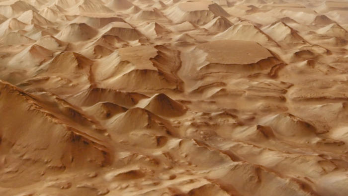
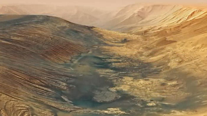
Hydraotes Chaos
Among the most interesting landforms on Mars are features referred to as 'chaotic terrain'. Dozens or even hundreds of isolated mountains are scattered in these extensive regions.

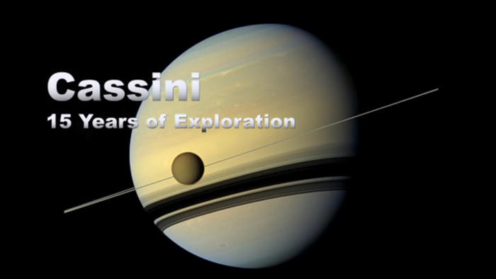
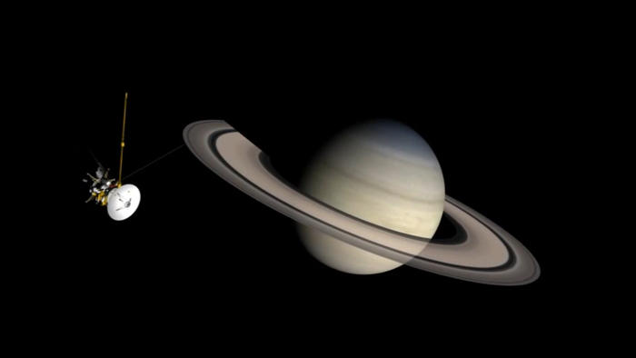
15 years Cassini-Huygens
This video highlights sights and sounds from the mission. The spacecraft Cassini launched 15 years ago and has been exploring the Saturnian system since 2004 successfully.

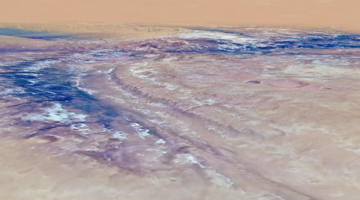
Kasei Valles
Kasei Valles is one of the largest outflow channel systems on Mars that was created by several gigantic flood events over 3 billion years ago.

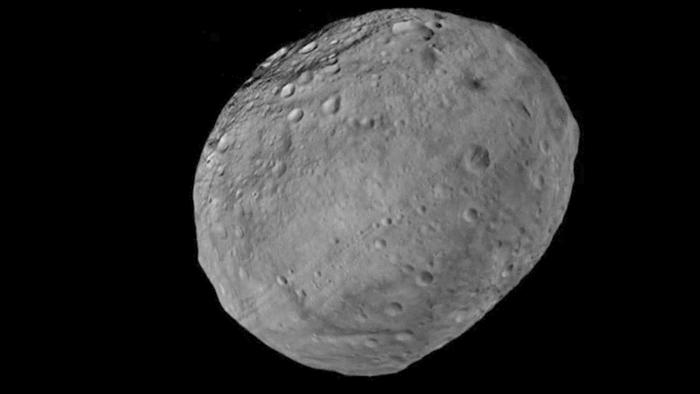
Asteroid Vesta
The asteroid Vesta is the third largest body in the asteroid belt (with dimensions of 280 x 270 x 230 kilometer) and one of a few relicts from early times of the solar system.

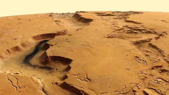
Dao and Niger Valles
This complex outflow-channel system on Mars is up to 40 km wide in places. The northern Dao Vallis is about 2400 m deep, the southern Niger Vallis about 1400 m.

Ulyxis Rupes
Ulyxis Rupes is located in the southern highlands of our neighbour planet Mars. There are many ice deposits and dune formations in this area.

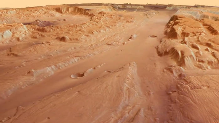
Valles Marineris
This animation shows a fly-over of the central region of the vast canyon system Valles Marineris, a significant geological structure on Mars.

Saturnian moon Iapetus
This animation shows a small part of the massive equatorial ridge on Iapetus. The ridge encircles the Saturnian moon along the equator.

Mawrth Vallis
This large outflow channel is situated north of the Martian dichotomy boundary between the southern highland and the northern lowland.

Impact crater Nicholson
Nicholson Crater is located northwest of a region called Medusae Fossae on Mars. In the centre of this crater an oblong massif rises around 3.5 km above the floor.

Hebes Chasma
Hebes Chasma is an almost 8 km deep basin on Mars, stretching 315 km in an east-west direction and 125 km from north to south.
Image Credits
special19_still
Image Credit: —
Neukum Crater
Image Credit: ESA/DLR/FU Berlin (CC BY-SA 3.0 IGO)
north_pole
Image Credit: —
mawrth16
Image Credit: —
landing-site
Image Credit: —
AtlantisChaos
Image Credit: —
Becquerel
Image Credit: —
Hydraotes Chaos
Image Credit: ESA/DLR/FU Berlin
Cassini 15years
Image Credit: NASA/JPL-Caltech/SSI/ASI
Kasei Valles
Image Credit: ESA/DLR/FU Berlin
Vesta
Image Credit: NASA/JPL-Caltech/UCLA/MPS/DLR/IDA/FU Berlin
Dao Valles
Image Credit: ESA/DLR/FU Berlin
ulyxis
Image Credit: —
Valles Marineris
Image Credit: ESA/DLR/FU Berlin
Iapetus
Image Credit: NASA/JPL-Caltech/FU Berlin
mawrth
Image Credit: —
Nicholson Crater
Image Credit: ESA/DLR/FU Berlin
Hebes Chasma
Image Credit: ESA/DLR/FU Berlin