TF0070 : Lincoln Eastern Bypass (A15)
taken 4 years ago, near to Washingborough, Lincolnshire, England
This is 1 of 4 images, with title starting with Lincoln Eastern Bypass in this square
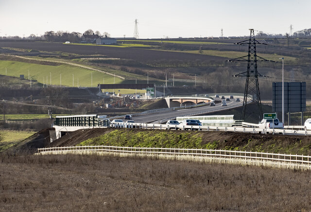
Lincoln Eastern Bypass (A15)
Looking south from Greetwell Road towards the River Witham and Railway bridges.
Lincoln Eastern Bypass
The A15 Lincoln Eastern Bypass is a 7.5km road designed to improve Lincolns infrastructure, encourage growth, minimise traffic congestion and enhance the inter-city environment.
The bypass starts at a new roundabout on the A15 Sleaford Road and finishes at the A158 Wragby Road.
This connects with the existing northern relief road and becomes the next step towards creating a complete ring road around the city.
The bypass opened on the 19th December 2020, some 8 years after it was planned. It cost £120 million.
(Info: Lincolnshire County Council website)
![Creative Commons Licence [Some Rights Reserved]](https://s1.geograph.org.uk/img/somerights20.gif)
|
· Find out How to reuse this image ·
Share:
|
|||||
| Start a discussion on TF0070 | Suggest an update to this image | Contact the contributor | |||
 Map © Crown Copyright")
TIP: Click the map for more Large scale mapping
- Grid Square
- TF0070, 49 images (more nearby
 )
)
- Photographer
- Julian P Guffogg (find more nearby)
- Date Taken
- Sunday, 20 December, 2020 (more nearby)
- Submitted
- Sunday, 20 December, 2020
- Geographical Context
- Road (from Tags)
- Near (from Tags)
- Primary Subject of Photo
- Subject Location
-
OSGB36:
 TF 004 708 [100m precision]
WGS84: 53:13.5071N 0:29.8097W - Camera Location
-
OSGB36: TF 007 717
- View Direction
- South-southwest (about 202 degrees)
Looking for a postcode? Try this page
Other Tags
Image Type (about):
cross grid
This page has been viewed about 76 times.
View this location:
KML (Google Earth) ·
Google Maps ·
Bing Maps ·
Geograph Coverage Map ·
More Links for this image