Lincoln Eastern Bypass :: Shared Description
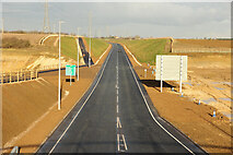
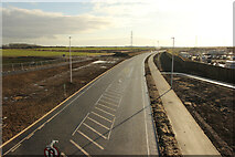
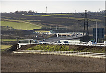
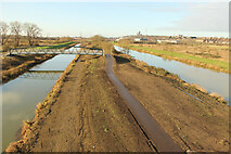
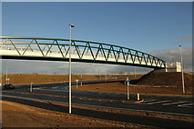
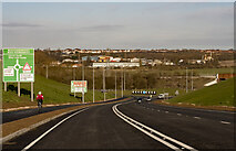
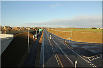
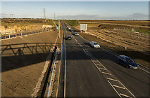
The A15 Lincoln Eastern Bypass is a 7.5km road designed to improve Lincolns infrastructure, encourage growth, minimise traffic congestion and enhance the inter-city environment.
The bypass starts at a new roundabout on the A15 Sleaford Road and finishes at the A158 Wragby Road.
This connects with the existing northern relief road and becomes the next step towards creating a complete ring road around the city.
The bypass opened on the 19th December 2020, some 8 years after it was planned. It cost £120 million.
(Info: Lincolnshire County Council website)
Related descriptions
- Flood Evacuation Routes
By Bob Harvey. Used on 39 images
- The County Buildings, Crosslet
By Lairich Rig. Used on 15 images
- Calum's Road
By Anne Burgess. Used on 1 images
- Eventus business incubation centre
By Bob Harvey. Used on 4 images
- Hollybush Road footbridge, Bridgnorth
By Martin Tester. Used on 3 images
- "L" prefixed roads in RoI
By Eric Jones. Used on 163 images
- East Suffolk County Hall
By N Chadwick. Used on 3 images
8 images use this description:
- View all images using this description in the Browser | On a Map
- View all images using "Lincoln Eastern Bypass" Shared Description(s) | On a Map | (Just this shared description)
- Find images mentioning the words [ Lincoln Eastern Bypass ] | (in the Browser)
These Shared Descriptions are common to multiple images. For example, you can create a generic description for an object shown in a photo, and reuse the description on all photos of the object. All descriptions are public and shared between contributors, i.e. you can reuse a description created by others, just as they can use yours.
Created: Sun, 20 Dec 2020, Updated: Sun, 20 Dec 2020
The 'Shared Description' text on this page is Copyright 2020 Julian P Guffogg, however it is specifically licensed so that contributors can reuse it on their own images without restriction.