Public Tags
Other tags: Lowlands
Showing latest 50 of 489,582 images tagged with top:Lowlands tag.
|
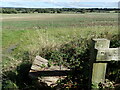
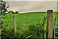
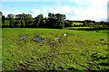
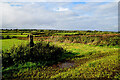
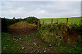
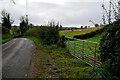
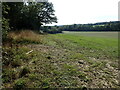
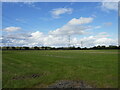
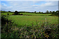
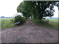
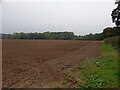
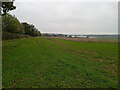
View from Gibbs Brook Lane
by Marathon geograph for square TQ3849 This looks eastwards across fields, just as Holly Bush Corner is reached along... (more)
|
|
View near Holly Bush Farm
by Marathon geograph for square TQ3849 This looks eastwards across fields, just as Holly Bush Corner is reached along... (more)
|
|
View from Gibbs Brook Lane
by Marathon geograph for square TQ3849 This looks eastwards across fields, just as Holly Bush Corner is reached.
|
|
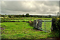
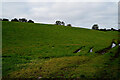
Lurganboy Townland
by Kenneth Allen geograph for square H3957 Looking west from Carryglass Road
|
|
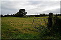
Meenagar Townland
by Kenneth Allen geograph for square H3958 Pictured along Carryglass Road
|
|
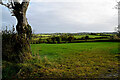
An open field, Meenagar
by Kenneth Allen geograph for square H3958 Pictured along Carryglass Road
|
|
Rough ground, Tonnagh More
by Kenneth Allen geograph for square H3958 Looking north-east from Corbally Road
|
|
A wet field, Tireenan
by Kenneth Allen geograph for square H4058 Looking south-west from Corbally Road
|
|
Muddy ground, Tireenan
by Kenneth Allen geograph for square H4058 Looking north-east from Corbally Road
|
|
Tireenan Townland
by Kenneth Allen geograph for square H4058 Pictured along Corbally Road
|
|
Tireenan Townland
by Kenneth Allen geograph for square H4058 Looking north-east from Corbally
|
|
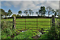
Corbally Townland
by Kenneth Allen geograph for square H4058 Looking south-west from Corbally Road
|
|
Rough ground, Corbally
by Kenneth Allen geograph for square H4058 Pictured along Drumhirk Road
|
|
Wet entrance to field, Corbally
by Kenneth Allen geograph for square H4058 Pictured along Drumhirk Road
|
|
Pump house, Corbally
by Kenneth Allen geograph for square H4057 Pictured along Drumhirk Road
|
|
Drumhirk Townland
by Kenneth Allen geograph for square H4057 Looking WSW from Drumhirk Road
|
|
Muddy entrance to field, Lisconreagh
by Kenneth Allen for square H4057 Pictured along Corrashesk Road
|
|
Lisconrea Townland
by Kenneth Allen geograph for square H4056 Looking south-east from Corrashesk Road
|
|
Lisconrea Townland
by Kenneth Allen geograph for square H4056 Pictured along Corrashesk Road
|
|
Lisconrea Townland
by Kenneth Allen geograph for square H3956 Looking west from the junction of Rahony Road and Corrashesk Road
|
|
Bend along Rahony Road
by Kenneth Allen geograph for square H3956 Heading south at Lisconrea
|
|
Lisconrea Townland
by Kenneth Allen geograph for square H3956 Looking west from Rahony Road
Ir. Lios Con Riabhach 'fort of the grey hound'
|
|
An open field, Lurganboy
by Kenneth Allen geograph for square H3957 Pictured along Rahony Road
|
|
Lurganboy Townland
by Kenneth Allen geograph for square H3957 Looking east from Carryglass Road
|
|
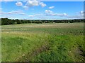
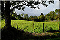
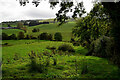
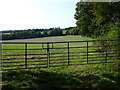
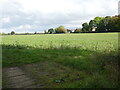
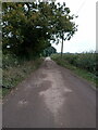
View near Bushes Farm Cottage
by Marathon geograph for square TQ5149 This view is from a pleasant lane wending its way across the Low Weald.
|
|
View near Bushes Farm Cottage
by Marathon geograph for square TQ5149 This view is from a pleasant lane wending its way across the Low Weald.
|
|
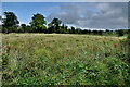
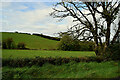
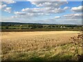
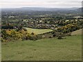
Trent Valley seen from Shelford Hill
by Jonathan Clitheroe geograph for square SK6741 Pictured from a roadside field entrance. The nearest area of woodland visible... (more)
|
|
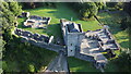
Mugdock Castle
by Fraser for square NS5477 Photograph from DJI Mini 2 drone, taken on 28.8.2021
|
|
River Wye at Tintern in Autumn
by Peter Randall-Cook for square SO5200 River Wye with Autumn light.
|
|
Dol Prior
by Eirian Evans geograph for square SN3619 Farm west of Carmarthen
|
|
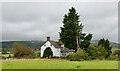
Little Brampton Farmhouse
by Trevor Littlewood geograph for square SO3681 The large farmhouse is close to the junction of the B4385 and B4368 on the north... (more)
|
|
The beginning of a footpath to Fiskerton Station
by Jonathan Thacker geograph for square SK7251 |
|
Power line near Morton
by Jonathan Thacker geograph for square SK7251 |
|
View towards Morton Manor Farm
by Jonathan Thacker geograph for square SK7251 |
|
Muddy tracks to field, Corbally
by Kenneth Allen geograph for square H4057 Pictured along Drumhirk Road
|
|
Stream, Drumhirk / Corbally
by Kenneth Allen geograph for square H4057 Pictured along Drumhirk Road
|
|
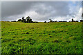
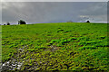
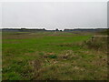
Distant sheep in a field, Drumhirk
by Kenneth Allen geograph for square H4057 Looking west from Drumhirk Road
|
|
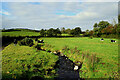
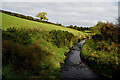
Burn, Corrashesk / Drumhirk
by Kenneth Allen geograph for square H4057 Pictured along Corrashesk Road
|
|
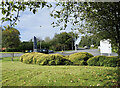
Access road for Lymm Services
by Trevor Littlewood geograph for square SJ6684 The Lymm motorway Services are close to the complex junction 9 at the crossing... (more)
Tags:
A Road (Classified A)X
Access RoadX
type:GeographX
HedgesX
top:Lowlands
Motorway ServicesX
top:Roads, Road TransportX
|
|
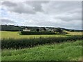
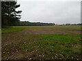
Field north of Loam Wood
by Richard Law geograph for square SJ7707 The first green shoots of the next crop (wheat, probably) are just starting to... (more)
|
|
Bike parked in a hedge
by Richard Law geograph for square SJ7707 My bike, specifically, which just about took me home before the heavens opened... (more)
|
|
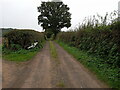
View along Bonemill Lane
by Richard Law geograph for square SJ7606 Bonemill Lane serves as access to a handful residential properties, and into the... (more)
|
|
Across fields towards Common Farm
by Richard Law geograph for square SJ7605 |
|
Bike parked in a hedge
by Richard Law geograph for square SJ7605 My bike, specifically, which is leaning against a hedge on the bridleway/drive... (more)
|
|
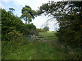
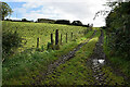
A field beside the bridleway to Twybrook Cottage
by Richard Law geograph for square SJ7605 |
|
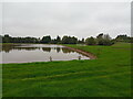
NE bank of an irrigation pool
by Richard Law geograph for square SJ7506 This pool lies in fields northwest of Upton Lane
|
|
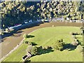
Southwest view
by don cload geograph for square TQ2451 |
|
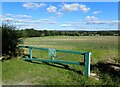
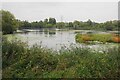
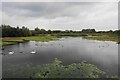
RSPB Rye Meads
by Bill Boaden geograph for square TL3810 A wetland reserve in the Lea Valley. This is the view from Gadwell Hide.
|
|
Field edge beside Upton Lane
by Richard Law geograph for square SJ7506 A gloomy afternoon, with rain not far off arriving.
|
|
RSPB Rye Meads
by Bill Boaden geograph for square TL3810 A wetland reserve in the Lea Valley. This is the view from Draper Hide.
|