

COCHISE COUNTY - If you’re looking for a challenging trail and want to stay cool this weekend, head over to the Cochise Trail near Dragoon, Arizona!
COCHISE COUNTY - If you’re looking for a challenging trail and want to stay cool this weekend, head over to the Cochise Trail near Dragoon, Arizona!

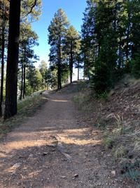
MT LEMMON – It is that time of year when hikers head to the mountains to escape the heat!

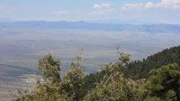
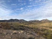
COCHISE COUNTY - The Carr Peak Trail offers some of the best views in the Huachucas and while it’s easy to access, it’s not the easiest hike.

Tucson, Ariz. (KVOA) — In the shadows of Pusch Ridge lies the Linda Vista Trailhead.

TUCSON - This week, we’re heading up to the Northwest side of Tucson to the Pima Canyon Trail!

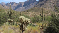
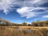
SIERRA VISTA - Looking for an oasis in the desert this weekend? Hittin' the trails has a great hike for you where water is the big draw.

We're tracking the hottest temperatures so far next week and with that in mind, here are some reminders on how to hit the trails safely during…

MOUNT LEMMON - Let's go Hittin' the Trails atop Mt. Lemmon's Meadow Loop Trail!

MT LEMMON - Looking to beat the heat this weekend? Head up to Mount Lemmon and take on the beautiful Butterfly Trail!

TUCSON - It's a place popular for mountain bikers but caters to the hiking crowd too! The Starr Pass Trailhead sits in the Tucson Mountains ne…
TUCSON - Looking for a short, scenic hike that also packs a punch? Check out the Dutch John Trail.

With triple-digit weather just around the corner, heat, sun exposure and dehydration are more likely to happen, even more so on hiking trails.
TUCSON - In the shadows of Pusch Ridge lies the Linda Vista Trailhead.

TUCSON - Today we're Hittin' the Trails in the Catalinas and this one will definitely make you sweat.

Looking for a hiking spot this weekend…that’s dog friendly? Then you may want to hit the trails at the Black Rock Loop!

TUCSON - It has been a while since we've gone Hittin' the trails in Madera Canyon at the Old Baldy Trail!
Looking for an oasis in the desert this weekend? Hittin' the trails has a great hike for you where water is the big draw.

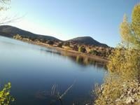
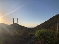
Today, we are Hittin' the Trails in the heart of Cochise County at the San Pedro Trail.
We’re hittin’ the trails today in the Tucson Mountains at the Brown Mountain Trail.
TUCSON - This week, we’re heading up to the Northwest side of Tucson to the Pima Canyon Trail!

TUCSON - This week we’re Hittin’ the Trails in the Tucson Mountains because it’s easy to get to and this trail is only a 20 minute drive from …

TUCSON - For this week's Hittin' the Trails we are heading to Saguaro National Park East where there are several trails to choose from. We're …
Dove Mountain is home to some of the world's best hiking trails! The Tortolita Mountains are a treasure trove for those looking to go Hittin' …

Hit up the Ventana Canyon Trail if you are looking for a challenging but rewarding oasis. Remember to stay hydrated!
If you want to take a hike to history, check out the King Canyon Trail!This trail is located at Saguaro National Park West in the Tucson Mountains.
In the shadows of Pusch Ridge lies the Linda Vista Trailhead.

TUCSON - It's a place popular for mountain bikers but caters to the hiking crowd too! The Starr Pass Trailhead sits in the Tucson Mountains ne…

This trail sits along the base of the San Pedro River. Experienced hikers can go the full 30-mile distance along this trail, but this spot is …
Sign up to receive News 4 Tucson email alerts -- breaking news, latest headlines, weather and more!
Get breaking news email alerts delivered to your inbox.
Get the latest local news, weather and sports headlines. (M-F)
Be prepared for your day and the week ahead with the latest forecast.