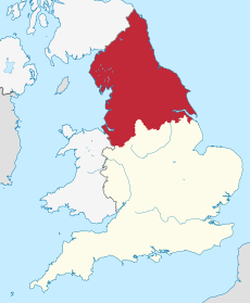
Category:Northern England
Jump to navigation
Jump to search
cultural area of Great Britain | |||||
| Upload media | |||||
| Instance of |
| ||||
|---|---|---|---|---|---|
| Patron saint | |||||
| Location | England | ||||
| Located in or next to body of water | |||||
| Executive body |
| ||||
| Maintained by |
| ||||
| Significant event |
| ||||
| Highest point |
| ||||
| Population |
| ||||
| Area |
| ||||
| Follows |
| ||||
| Visitors per year |
| ||||
 | |||||
Media in category "Northern England"
The following 12 files are in this category, out of 12 total.
-
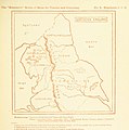
19 of 'The “Beaumont” Geography and Map Tracing Book' (11247014584).jpg 1,970 × 1,995; 728 KB
-
21 of 'The “Beaumont” Geography and Map Tracing Book' (11245673235).jpg 1,970 × 1,987; 717 KB
-
61 of 'The “Beaumont” Geography and Map Tracing Book' (11247897876).jpg 1,970 × 2,440; 938 KB
-
Cursive IPA sample (1912).png 2,038 × 1,348; 298 KB
-
Doncaster Flag.jpg 1,800 × 900; 167 KB
-
EnglishNorthMidlandsCountiesMap.png 623 × 567; 27 KB
-
Flag of Doncaster.jpg 1,800 × 900; 201 KB
-
HS2 classic network UK north.png 1,800 × 1,550; 330 KB
-
Integrated-rail-plan-for-the-north-and-midlands.pdf 1,239 × 1,752, 162 pages; 11.94 MB
-
Map of Northern England with settlements and traditional counties.png 660 × 707; 162 KB
-
Red Brick Houses, Geoffrey W. Birks (1929-1993), British.png 1,440 × 821; 544 KB
-
Trans-Pennine Routes.svg 2,793 × 1,577; 4.72 MB


