(Translated by https://www.hiragana.jp/)
Google Lat Long: September 2012


On the Google Earth Outreach team, we’re very lucky to work with organizations around the world who are practicing “Geo for Good:” using maps to help make the world a better place. We’ve worked with organizations that ...

On the Google Earth Outreach team, we’re very lucky to work with organizations around the world who are practicing “Geo for Good:” using maps to help make the world a better place. We’ve worked with organizations that save elephants in Africa, clear landmines around the world and protect our coastlines. As part of our ongoing support for non-profits that use Google mapping tools to help change the world, we hosted the Geo for Good User Summit this week at our Google headquarters in Mountain View.

85 nonprofit organizations attended this week’s Summit -- old partners and new -- spanning the globe from the Galapagos to the Appalachian Mountains of the United States to the forests of Sumatra, and working on a range of issues such as conservation, humanitarian relief and cultural preservation. They received hands-on training of all the new mapping tools that Google makes available to users around the world, including Google Maps Engine, Google Earth Engine and Google Earth Enterprise Portable Solution.


Brian McClendon, VP Google Maps and Google Earth, addressing the Geo for Good attendees

As part of our event this week, we also announced the latest addition to our Google Earth Outreach Grants program: Google Maps Coordinate. Google Maps Coordinate is a workforce management tool that allows organizations to quickly and easily assign jobs to field workers, improving operational efficiency and communication. We’re looking forward to helping non-profits use Google Maps Coordinate to do things like deploy urban forestry teams, urban car-sharing services, or mobile health workers to conduct surveys in villages. Eligible non-profits in the U.S., U.K. and Canada are welcome to apply for a Google Maps Coordinate grant today.


Our quest to create the most comprehensive and accurate map of the world is ongoing, but we’re happy to take a pause and share some impressive progress that our Google Maps ...

Our quest to create the most comprehensive and accurate map of the world is ongoing, but we’re happy to take a pause and share some impressive progress that our Google Maps and Earth imagery teams have recently made. We’ve refreshed the high resolution aerial and satellite imagery for many places around the world, and released some new 45 degree imagery as well.


New 45° imagery available for 51 cities:

In addition, 45° imagery is now available in Google Maps for 37 U.S. and 14 international locations. Below are some examples of the beautiful new views from Pisa, Italy and Winnipeg, Canada.

Probably one of the most famous landmarks in the world is the Leaning Tower of Pisa. Its construction started back in 1173 and extended over a period of almost 350 years. Due to increasing incline during the last Century, a stabilization effort was performed that took almost two decades to complete. Today the tower is said to be safe from collapsing for at least 200 more years.


Leaning Tower of Pisa - Can you detect the angle?

In the language of the native Cree people, the city’s name of Winnipeg means “muddy waters.” The first European settlements in the area were several fur trading posts started around 1738. Today Winnipeg’s economic and educational significance within Canada is undoubted. Below is an image of The Forks which designates the confluence of the Red and Assiniboine Rivers.


The Forks in Winnipeg, Canada - View Larger Map


New high resolution aerial and satellite imagery:

The aerial and satellite imagery in Google Maps and Earth has now been updated for 17 cities and 112 countries/regions. Below are a few highlights from our latest release:

The aerial image below shows the pentagon-shaped Citadel of Lille, in Lille, France. It was built in 1668 and designed by the great military engineer of the time, Sébastien Le Prestre de Vauban.


Citadel of Lille, France - View Larger Map

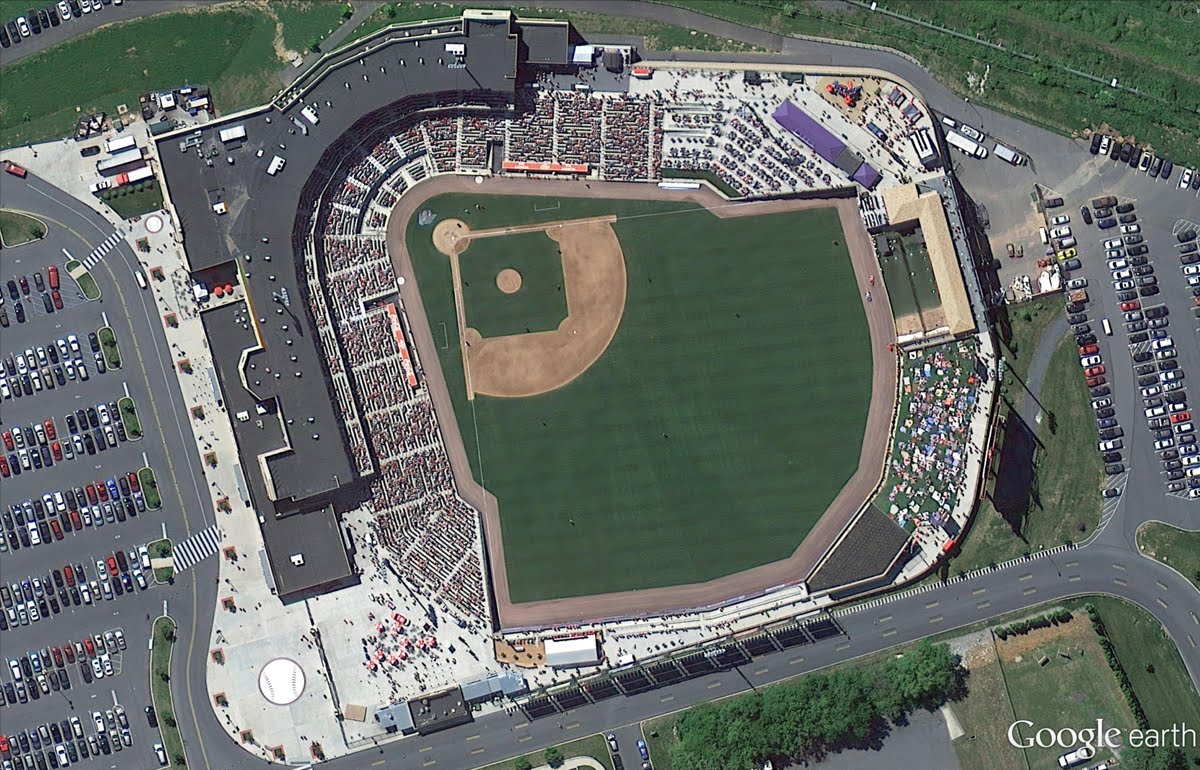
The next aerial imagery shown below was taken earlier this month of the Texas State Capitol and adjoining grounds in Austin, Texas. The building is recognized as a National Historic Landmark.


Texas State Capitol in Austin, Texas - View Larger Map

Below is the full list of places with new or updated imagery. Have fun exploring the new sites!

Cities with new high resolution 45° imagery:
United States: Ames, IA; Anderson, IN; Billings, MT; Bloomington, IL; Carmel Valley, CA; Cedar Rapids, IA; Coeur d'Alene, ID; Corvallis, OR; Danville, IL; Dayton, OH; Detroit, MI; Dubuque, IA; Elizabethtown, KY; Enid, OK; Florence, SC; Grand Forks, ND; Great Falls, MT; Gulfport, MS; Hartford, CT; Kankakee, IL; Kenosha, WI; Lafayette, IN; Lancaster, CA; Lansing, MI; Lewiston, ID; Los Banos, CA; Sun Prairie, WI; Medford, OR; Michigan City, IN; Olympia, WA; Pocatello, ID; Sheboygan, WI; Sioux City, IA; Sioux Falls, SD; South Bend, IN; Terre Haute, IN; Utica, NY.

International: Angers, France; Clermont-Ferrand, France; Coimbra, Portugal; Dijon, France; Grenoble, France; Livorno, Italy; Lyon, France; Newcastle, United Kingdom; Oberhausen, Germany; Palermo, Italy; Pisa, Italy; Toulouse, France; Troyes, France; Winnipeg, Canada.

Areas with new high resolution aerial updates:
Florence OR, Kellogg ID, Casper WY, North Platte NE, Concordia KS, Alva OK, Austin TX, Nevada MO, Chilicothe MO, Toulouse FR, Clermont-Ferrand FR, Angers FR, Nantes FR, Troyes FR, Lille FR, Thun CH, Lucca IT

Areas new high resolution satellite updates:
Canada, United States, Mexico, Cuba, Jamaica, Haiti, Dominican Republic, Guatemala, Honduras, Nicaragua, Costa Rica, Panama, Colombia, Venezuela, Brazil, Peru, Bolivia, Paraguay, Uruguay, Argentina, Antarctica, South Africa, Namibia, Botswana, Mozambique, Zimbabwe, Madagascar, Zambia, Angola, Malawi, Tanzania, Democratic Republic of the Congo, Kenya, Somalia, Ethiopia, South Sudan, Sudan, Uganda, Central African Republic, Nigeria, Cameroon, Chad, Niger, Benin, Ghana, Burkina Faso, Ivory Coast, Guinea, Sierra Leone, Mali, The Gambia, Senegal, Mauritania, Western Sahara, Morocco, Algeria, Tunisia, Libya, Egypt, Israel, Saudi Arabia, Yemen, Oman, Qatar, United Arab Emirates, Kuwait, Turkey, Iran, Ireland, Norway, Sweden, Portugal, Spain, France, Italy, Poland, Lithuania, Finland, Belarus, Ukraine, Moldova, Romania, Hungary, Austria, Croatia, Serbia, Bulgaria, Greece, Russia, Kazakhstan, Uzebekistan, Turkmenistan, China, Pakistan, India, Sri Lanka, Bangladesh, Thailand, Nepal, Bhutan, Myanmar, Laos, Vietnam, Korea, Japan, Mongolia, The Philippines, Malaysia, Indonesia, Australia, New Zealand


In the spirit of making Google Maps more comprehensive and accessible to people around the world, today we’re introducing Google Street View imagery of Chile and Croatia. We hope that these images are useful to both locals who want to scope out their own neighborhoods as well as tourists who are planning trips to either of these scenic countries.

You can now can explore the streets of three Chilean cities: Concepción, Santiago and Valparaíso. In Santiago, you can discover the Mercado Central in Santiago and see why this tourist spot was named one of the world's ten best in its class.  


View larger map

Moving west, scope out the steep streets and beautiful views of the Port of Valparaíso from your computer before heading out with your own camera. Or go a few hundred miles south of Santiago to Concepción, where you can “walk” across the extensive bridge over the Bio Bio River.

In Croatia, we’ve mapped many towns and cities; from the bustling city centre of the capital Zagreb, to picturesque coastal towns like Split and Dubrovnik.

Virtual tourists now can explore the old city of Dubrovnik with its impressive Gothic and Renaissance architecture such as the Assumption Cathedral below. Although suffering severe damage during an earthquake in the mid-17th century, many churches, monasteries and palaces are still well preserved and can be seen in Street View.


Another must-see location is St. Mark’s Square, build around the Church of St. Mark, the parish church in the old part of Zagreb. The square is also the place where Croatia’s presidents are inaugurated.
Since launching the Street View feature of Google Maps in 2007, we’ve captured imagery from more than 3,000 cities and 40 countries around the world. Chile and Croatia are just two of the newest locations people can explore in the Street View feature of Google Maps. Visit maps.google.com/streetview to learn more.

Posted by Ulf Spitzer, Program Manager, Google Maps


Today we’re adding the very first underwater panoramic images to Google Maps, the next step in our quest to provide people with the most comprehensive, accurate and usable map of the world. With these vibrant and stunning photos you don’t have to be a scuba diver—or even know how to swim—to explore and experience six of the ocean’s most incredible living coral reefs. Now, anyone can become the next virtual Jacques Cousteau and dive with sea turtles, fish and manta rays in Australia, the Philippines and Hawaii.

Get up close and personal with sea turtles at Heron Island, Great Barrier Reef (View Larger Map)

Starting today, you can use Google Maps to find a sea turtle swimming among a school of fish, follow a manta ray and experience the reef at sunset—just as I did on my first dive in the Great Barrier Reef last year. You can also find out much more about this reef via the World Wonders Project, a website that brings modern and ancient world heritage sites online. At Apo Island, a volcanic island and marine reserve in the Philippines, you can see an ancient boulder coral, which may be several hundred years old. And in the middle of the Pacific, in Hawaii, you can join snorkelers in Oahu’s Hanauma Bay and drift over the vast coral reef at Maui's Molokini crater.


We’re partnering with The Catlin Seaview Survey, a major scientific study of the world’s reefs, to make these amazing images available to millions of people through the Street View feature of Google Maps. The Catlin Seaview Survey used a specially designed underwater camera, the SVII, to capture these photos.

The Catlin Seaview Survey team on location on the Great Barrier Reef, encountering a manta ray (View Larger Map)

Whether you’re a marine biologist, an avid scuba diver or a landlocked landlubber, we encourage you to dive in and explore the ocean with Google Maps. Check out our complete underwater collection, featuring a Google+ underwater Hangout from the Great Barrier Reef. And you can always explore more imagery from around the world by visiting maps.google.com/streetview.

Explore more underwater images

Posted by Brian McClendon, VP of Google Maps and Earth (and snorkeling enthusiast)

(Cross posted on Google France Blog

Every day, millions of people use Google Maps to get where they need to go, including airports, shopping malls and museums. As of last year, people could continue using Google Maps once inside these popular locations, as we began our effort to provide ...
(Cross posted on Google France Blog

Every day, millions of people use Google Maps to get where they need to go, including airports, shopping malls and museums. As of last year, people could continue using Google Maps once inside these popular locations, as we began our effort to provide indoor floor plans and directions via Google Maps for Android.

Today, we’re expanding the coverage of this indoor maps feature to include popular French venues, making the maps of France more comprehensive, accurate and usable for both locals and travelers alike. Now, even if you’re visiting one of these large, well-trafficked places for the first time, you can navigate your way around like a pro. And with the accurate My Location feature that works indoors, you can easily figure out if you’re close to the shop you’re looking for, the escalator that will get you to the right gate, or even the nearest ATM or restroom.

We’ve worked with more than 50 French venues, including shopping malls, retailers, airports and museums, to have their indoor floor plans appear on Google Maps for Android. We even partnered with super markets such as Carrefour so that you can look for items like the “dairy” aisle and figure out the fastest way to the milk products to save time when shopping.


Whether you use indoor maps to view the different departments of iconic French retailers like Galeries Lafayette Montparnasse, or simply to find your way to a fresh loaf of bread at the local Carrefour supermarket, Google Maps for Android can help you explore the great indoors. For a list of locations for which indoor maps are available, check out our Help Center article here.

Otherwise, start your indoor adventure here!


Today, Google Maps is expanding its offering of live road traffic in three new cities: Jeddah, Saudi Arabia; Kuwait City, Kuwait and Guayaquil, Ecuador. Now, the maps of these locations are much more useful, as drivers can quickly determine the clearest route to their destinations and reduce the amount of time spent in the car. In addition to being able to see current traffic conditions, estimated travel times are also available to ease anxiety and help you plan your trips accordingly.

Today, Google Maps is expanding its offering of live road traffic in three new cities: Jeddah, Saudi Arabia; Kuwait City, Kuwait and Guayaquil, Ecuador. Now, the maps of these locations are much more useful, as drivers can quickly determine the clearest route to their destinations and reduce the amount of time spent in the car. In addition to being able to see current traffic conditions, estimated travel times are also available to ease anxiety and help you plan your trips accordingly.


See road traffic in Jeddah, Saudi Arabia and Guayaquil, Ecuador

We’ve also improved the live traffic information to include more roads and highways in 15 regions where this popular feature of Google Maps is already available: Australia, Brazil, Canada, Czech Republic, France, Germany, Ireland, Italy, Japan, Portugal, Puerto Rico, Russia, Sweden, the U.K., and the U.S.

We hope this more comprehensive coverage provides a more accurate picture of the traffic conditions in these areas, and helps people to not only avoid getting stuck in traffic jams, but also more easily get where they want to go.


A quick glance at our live traffic coverage around the globe

For new users, simply check traffic conditions by visiting maps.google.com and clicking on the traffic layer in the widget on the upper right-hand side of the map. This useful traffic information is also available on Google Maps for Mobile devices and Google Maps Navigation.

Get traffic information on Google Maps for Android (Shown: Kuwait City, Kuwait)

And if the roads you’re traveling do not yet show traffic conditions, you can help! Simply opt in to using Google Navigation or Google Maps for Mobile while traveling to help your fellow drivers get improved traffic information.


When you’re on the go, it can be difficult to recall all of the places you’ve searched on your desktop browser at home. To make Google Maps more useful and comprehensive, we added a few improvements to better sync your maps experience across all of your devices. Today, with the latest release of ...

When you’re on the go, it can be difficult to recall all of the places you’ve searched on your desktop browser at home. To make Google Maps more useful and comprehensive, we added a few improvements to better sync your maps experience across all of your devices. Today, with the latest release of Google Maps for Android, we’re making it faster and easier for you to get the information you’ve searched for on your browser, right on your Android phone.

Just make sure you’re signed in to Google Maps and your web history is enabled to get a number of new benefits including search and directions history. When you start to type a place or directions into the search box on your Android device, you’ll see suggestions for directions and locations that you’ve previously searched for – making it easier to quickly find directions on the go.

Desktop and Mobile search synchronisation.

You can also see your mapping search history, as well as your directions history, on your Android phone by going to the “Search” or “Directions” tab under My Places. This way, places and businesses you have already searched for will show up in your suggestions to save you time when you’re out and about.


Access your search history under My Places.

Also, as in previous versions of Google Maps for Android, when you chose to set locations such as “home” and “work", you can quickly access directions to these places by simply typing “home” or “work” in the search field on your mobile device.
       
Searching for work automatically suggests your work address.

We’re always working to make your Google Maps experience more comprehensive, accurate and useful across all devices. To learn more about these features you can visit our site.

Posted by Keiji Maekawa, Software Engineer, Google Maps


Together with thousands of participating businesses owners around the world, we’ve been working hard to improve the comprehensiveness of interior, panoramic imagery available on Google and Google Maps.

Now, if you’re searching or browsing Google Maps and want to check out what a business looks like on the inside, we’ve improved your ability to find and view these 360-degree panoramics. Simply drag and drop the orange Pegman on the left hand side of your screen onto an orange circle on the map. Voila! You’ll be virtually transported through the doors, and able to pan around and explore the interior of the establishment.


Drop Pegman on the orange dots to get 360 degree interior views of participating businesses

From restaurants to retail shops to beauty salons and more, these interior Business Photos on Google Maps give you the feeling of being there, and the comfort of knowing what to expect when you arrive. Whatever the occasion, they can help you find a place with the right ambiance for a dinner date in Orlando, Florida, a resort in Canary Islands, Spain, or even preview an antique store in Austin, Texas.

To give you an even better idea of where and how you can find these helpful interior Business Photos, watch this video. Then let Google Maps help you explore the interiors of the participating places in your area.


In the blink of an eye, summer is coming to an end. It feels like it was just yesterday that I was planning out all my summer activities as I eagerly awaited the start of long, sunny days and warm nights.

In the blink of an eye, summer is coming to an end. It feels like it was just yesterday that I was planning out all my summer activities as I eagerly awaited the start of long, sunny days and warm nights.

Before we approach the official end of summer on September 21, our Google Maps team thought it’d be fun to see how those of us in the Northern Hemisphere have spent the dog days. To do this, we reviewed the summer search activity on maps.google.com in several countries between the end of May and the beginning of September. Within each country, a look at some of the top-rising searches and the often-searched landmarks on Google Maps gives us a sense of how people around the world spent their summers.

We’re honored that people rely on the comprehensive and accurate imagery in Google Maps to research, plan, preview and digitally experience distant as well as local destinations across the globe. Take a look and click through for a larger image:


North Americans sought out the best local beaches to help cool off from the summer heat. In comparison, many more people from Spain, Italy and France searched for community swimming pools. In cooler areas of the U.K. the rising Google Maps searches included many indoor activities such as squash, bars and going to the gym. And, as expected, travel was a clear choice for the summer, as indicated by a surge in searches for lodging in almost every region.

Many popular destination searches were located outdoors. National parks and Hawaiian islands were the most popular searches in the U.S., while local parks, zoos, gardens and playgrounds topped Canada’s and Europe’s list. Major landmarks such as the Empire State Building in New York City, Niagara Falls in Canada, the Eiffel Tower in Paris, and the Taj Mahal in India also topped the list of often-searched places in Google Maps. And of course, with the Summer Games drawing in international audiences, Wembley Stadium and the Olympic Stadium were two of the most searched for locations throughout the UK this summer.

Check out the destinations that captured people’s attention this summer and see how your interests compared to others around the world. We hope you enjoy this look back to remember the fun places we all went with Google Maps this summer, and we can’t wait to help you find your next adventure!

Today’s guest authors are Rob Heittman from Solertium, Inc., a technical development company and Iain Douglas-Hamilton, founder of Save the Elephants, based in Kenya. Save the Elephants was the recipient of a Google Earth Outreach Developer Grant, funded through the Google Inc. Charitable Giving Fund at the Tides Foundation. We’re hoping that mapping data patterns over time will shed much-needed light on the recent dramatic increase in poaching of elephants in Africa. ...

Editor’s note: Today’s guest authors are Rob Heittman from Solertium, Inc., a technical development company and Iain Douglas-Hamilton, founder of Save the Elephants, based in Kenya. Save the Elephants was the recipient of a Google Earth Outreach Developer Grant, funded through the Google Inc. Charitable Giving Fund at the Tides Foundation. We’re hoping that mapping data patterns over time will shed much-needed light on the recent dramatic increase in poaching of elephants in Africa.

History is currently repeating itself in a quite unpleasant way.

Once again, as we did in the 1970s and 1980s, we are seeing previously tranquil elephants affected by huge surges in the illegal killing of elephants for ivory. We know, from past experience, that this ivory rush is fueled by a sudden increase in demand: new prosperity in Asian markets, where ordinary people can suddenly afford to buy ivory. After a relative respite since the 1989 ivory trade ban, I am sad to report that elephants are once again in peril.

Murembo, a bull elephant, from Tsavo National Park, Kenya
Photo Credit: Johan Marais

Save The Elephants operates a research camp in Samburu, Kenya; a very special place. The elephants there are protected by law, the ceaseless efforts of the Kenya Wildlife Service, local stakeholders, and amazing technology that helps secure their future. Within Samburu -- and other places in Africa -- we provide a tracking system which uses GPS radio collars to monitor the movements of elephants in near real time. Using Google Earth and our new, lightweight mobile apps, our team can be deeply knowledgeable about the Samburu elephants, and share data with the guardians to come to their aid if needed. Alerts tell us when unusual conditions occur. The most serious alert concerns immobility. This too often means another poaching incident, and another elephant's life lost to runaway demand for ivory.


Save the Elephants’ private Android and iOS apps allow for real-time elephant tracking, alerting rangers to elephants movements and poaching incidents.

We believe the ivory poaching we're seeing is a microcosm of what is going on across Africa. This past year, especially, there have been a series of massacres, for example, one in Cameroon in which almost an entire population was wiped out with automatic weapons.


Just 10 years ago, the areas in red, where illegal elephant killing is peaking, were showing healthy or stable elephant populations in green. Explore the changes over time in the timelapse feature.  Since 2008, major deterioration set in.

The other necessary part of the solution is to reduce the demand. Here, technology can also be a powerful ally. We are now using new Google technologies to bring the same level of awareness to anyone with a Web browser. With our most recent initiative, the Elephants in Peril site (http://www.elephantsinperil.org), we have turned to Fusion Tables and Google Maps Engine to do two important things. First, we are working to bring together public data sets, often buried in boring official reports, to reveal the complete story of elephant populations over time, map them out, and understand what trends can be seen. Second, we aim to share the real, unvarnished scientific data from whatever sources in a citable, and highly usable form.

As long as elephants continue to be threatened by surging ivory demand, we want Elephants in Peril to become a reliable source, whether a visitor wants to learn about the problem, write, tell about it, or take steps to help solve it. Google's simple data publishing and visualization tools make it possible for us to undertake this effort and reach a larger audience than would otherwise be possible.


elephantsinperil.org map shows main populations left in Africa with green being high density and red being low density.

We are in a race with the poachers; a race we have to win. Google Earth, Google Maps Engine, and Fusion Tables give us the advantage of speed. Already, we have used the system to share results with the media, and save weeks or months in achieving publicity. Later this year, we will publish original research that helps to tie our findings in Samburu to the challenges across the African continent, using the site to engage concerned individuals, NGOs and governments. In future, we look forward to translating the site into Chinese to improve its utility as a resource in Asia.

Google Earth Outreach and the Tides Foundation have made our mobile apps and Elephants in Peril possible. We welcome the assistance of any concerned Google developers or users. Please visit our website; even better, visit us in Africa if you can, and give us your ideas to help us win this race.

Posted by Dr. Iain Douglas-Hamilton, Founder of Save the Elephants, and Rob Heittman, CTO of Solertium, Inc.


September 12th is “Space Day” in Japan, and we are celebrating by releasing new, comprehensive Street View imagery for two of Japan’s top scientific institutions: the Japan Aerospace Exploration Agency (JAXA) and the National Museum of Emerging Science and Innovation (Miraikan). With panoramic imagery in and around these locations now available via the Street View feature of ...

September 12th is “Space Day” in Japan, and we are celebrating by releasing new, comprehensive Street View imagery for two of Japan’s top scientific institutions: the Japan Aerospace Exploration Agency (JAXA) and the National Museum of Emerging Science and Innovation (Miraikan). With panoramic imagery in and around these locations now available via the Street View feature of Google Maps, space enthusiasts around the world have a more complete and accurate sense of what it’d be like to virtually swap places with an astronaut.

The JAXA imagery allows you to walk through the Tanegashima Space Center (TNSC) down on the idyllic beach island of Tanegashima. TNSC is the site from which the Kounotori 3 rocket recently lifted off to send supplies (and the YouTube Space Lab winning experiments) to the International Space Station. You can start your tour of the TNSC facilities with a look inside the Space Science Technology Museum at the Southern tip of the island, and then a peek in the nearby Control Room.


Next, check out the launch pad with the huge open areas and launch tower.


Beyond the TNSC, you can also explore the immersive imagery from the JAXA facilities at Tsukuba Space Center, Sagamihara Campus, Chofu Air and Space Center, Earth Observation Center, Usuda Outer Space Observatory, and the Uchinoura Space Center.

In addition, today’s release also includes 360-degree views of the National Museum of Emerging Science and Innovation, known in Japan as the “Miraikan.” Now, you’re able to virtually walk inside the museum and see the famous “Geo Cosmos” hanging Earth model, as well as the other permanent exhibits like the model of the International Space Station.


We thank JAXA and the Miraikan for working with us to collect and share the new Street View imagery for these breathtaking and important sites of space innovation and technology. We hope the imagery on Google Maps brings the science of outer space much closer to people around the world.


Improving the availability of more high quality imagery is one of the many ways we’re continuing to bring you the most comprehensive and accurate maps of the world. In this month’s update, you’ll find another extensive refresh to our high resolution aerial and satellite imagery (viewable in both ...

Improving the availability of more high quality imagery is one of the many ways we’re continuing to bring you the most comprehensive and accurate maps of the world. In this month’s update, you’ll find another extensive refresh to our high resolution aerial and satellite imagery (viewable in both Google Maps and Google Earth), as well as new 45 degree imagery in Google Maps spanning 30 new cities.

New high resolution aerial and satellite imagery:

Google Maps and Earth now feature updated aerial imagery for more than 20 locations, and updated satellite imagery for more than 60 regions. Here are a few interesting locations included in our latest release.

Below is imagery of Mecca, Saudi Arabia where each year more than 15 million Muslims visit this important religious site. Here you can see Abraj Al Bait, one of the world largest clock towers, visible even from space!


Abraj Al Bait is the world’s largest clock face

On the opposite side of the globe, baseball season in the United States is in full swing and fans can’t get enough. Below is an aerial image of Coca-Cola Park in Pennsylvania, home of the Lehigh Valley IronPigs, a minor league affiliate of the Philadelphia Phillies.


Coca-Cola Park in Allentown, Pennsylvania

New 45° imagery available for 30 cities:

In addition, this month’s Google Maps update includes 45° imagery coverage for 23 U.S. cities and 7 international locations. Below are some highlights from Bordeaux, France and Cincinnati, Ohio.

Bordeaux is a major city in southwestern France, located roughly 45 kilometers from the Atlantic Ocean. It is especially famous for its wine and cuisine, and the image below shows the Gothic style Saint-André Cathedral.


Cincinnati, Ohio, was the first major inland city in the United States known for its large collection of historic architecture . Below is the Over-The-Rhine neighborhood, which exemplifies the historic Italianate Architecture that can be found throughout Cincinnati.


Below is the full list of cities boasting new or updated imagery.

Cities with new high resolution 45° imagery:
United States: Bend, OR; Bloomington, IN; Buffalo, NY; Cincinnati, OH; Columbus, IN; Columbus, OH; Conway, SC; Evansville, IN; Fort Wayne, IN; Gastonia, NC; Hamilton, OH; Indianapolis, IN; Jackson, TN; Joliet, IL; Kokomo, IN; Lincoln, NE; Louisville, KY; Mankato, MN; Muncie, IN; Owensboro, KY; Palm Valley, FL; Rochester, MN; Wilmington, NC.
International: Béziers, France; Bordeaux, France; Lille, France; Marseille, France; St. Etienne, France; Platja d'Aro, Spain; Blanes, Spain.

Areas with new high resolution aerial imagery:
United States: Centralia WA, Tillamook OR, Salem OR, Dos Rios CA, Mount Shasta area CA, Lassen area CA, Joshua Tree area CA, Ely NV, Elko NV, Las Vegas NV, Lander WY, Onawa IA, Ames IA, Perry IA, Bolivar MO, Mountain Grove MO, Rolla MO, Coldwater KS, Spearman TX, Hereford TX, San Antonio TX, Tyler TX, Lafayette LA, Huntsville AL, Waycross GA, Palatka FL, Fort Pierce FL, Allentown PA
Portugal: Torre de Coelheiros
Spain: Baiona, Ourense, Torrelavega, San Sebastian, Pamplona, Nulles, Guadassuar, San Miguel de Salinas, Castellar de la Frontera, Los Palacios y Villafranca, Bailen
France: Bordeaux, Montpellier, Lyon, Dijon, Grenoble
Italy: Livorno, Rome, Catania
Switzerland: Montreux, Neuchatel, Zurich
England: Olympic Park
Germany: Munich, Heidelberg, Flieden, Alsfeld,
Austria: Salzburg

Areas new high resolution satellite updates:
USA, Greenland, Mexico, Colombia, Venezuela, Brazil, Bolivia, Paraguay, Argentina, Antarctica, South Africa, Namibia, Zimbabwe, Mozambique, Zambia, Angola, Democratic Republic of the Congo, Uganda, Kenya, Central African Republic, Cameroon, Ethiopia, Burkina Faso, Guinea, Algeria, Morocco, Western Sahara, Egypt, Saudi Arabia, Syria, Greece, Macedonia, Bulgaria, Romania, Ukraine, Bosnia and Herzegovina, Croatia, Hungary, Poland, Belarus, Lithuania, Estonia, Russia, Khazakhstan, Uzbekistan, Iran, Pakistan, India, Nepal, Bhutan, China, Myanmar, Thailand, Cambodia, North Korea, South Korea, Japan, Philippines, Indonesia, Papua New Guinea, Australia, New Zealand

If you’d like to receive an email notification when imagery for the areas you care about are updated, check out the Follow Your World tool. Enjoy the new sites!

Update (9/7): Satellite and aerial image mentioned is currently available in Google Earth only and will be coming to Google Maps shortly. 


Maps keep our spirit of adventure alive by making it easier for us to explore the world around us. That’s why today, we’re making Google Maps even better with new turn-by-turn navigation with traffic conditions, biking directions, Map Maker and new Street View imagery in more locations globally. These improvements are part of our ongoing effort to build the best map we can -- one that’s comprehensive, accurate and easy for you to use.

Maps keep our spirit of adventure alive by making it easier for us to explore the world around us. That’s why today, we’re making Google Maps even better with new turn-by-turn navigation with traffic conditions, biking directions, Map Maker and new Street View imagery in more locations globally. These improvements are part of our ongoing effort to build the best map we can -- one that’s comprehensive, accurate and easy for you to use.

First, we’re expanding Google Maps Navigation (Beta) with voice guided, turn-by-turn directions in thousands of towns across India. Navigation is one of the most frequently requested features in this region and can be especially helpful when driving in densely populated cities like Delhi or Bangalore. We’re also adding live traffic conditions for major roads with estimated travel times to help you save time and to reduce stress on the road.

Turn-by-turn voice navigation in New Delhi, India

Biking directions and Map Maker are also now rolling out to New Zealanders. Local cyclists can access biking directions directly on Google Maps, and use Map Maker to add bike lanes and trails if their favorite route is missing or they discover a new one. Beyond biking trails, Map Maker can also be used to make the New Zealand map more accurate with details such as new road names, building footprints and more.

Biking directions from Remuera in Auckland to the local Google office

Later today, we’ll also release new Street View imagery for more than 150 university campuses globally. With classes just getting started, freshman students, transfers and even empty-nesting parents can now familiarize themselves with college campuses around the world, including UCLA in the U.S., Pembroke College in the U.K., McGill University in Canada and Sophia University in Japan. These new panoramic views join our growing list of universities whose campuses are already available in Google Maps.


View Larger Map
Royce Hall at the University of California, Los Angeles

Finally, to celebrate all the places you can reach with Google Maps—all seven continents, the sky, the moon and even the depths of the ocean—we made a video that we hope will inspire you to keep exploring.


Keep exploring at maps.google.com/helloworld. Here’s to many new adventures.