Kettenkamp
Jump to navigation
Jump to search
Kettenkamp | |
|---|---|
 Flag  Coat of arms | |
Location of Kettenkamp within Osnabrück district 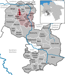 | |
 Kettenkamp  Kettenkamp | |
| Coordinates: 52°9′N 8°9′E / 52.150°N 8.150°E | |
| Country | Germany |
| State | Lower Saxony |
| District | Osnabrück |
| Subdivisions | 8 |
| Government | |
| • Mayor | Reinhard Wilke |
| Area | |
| • Total | 52.6 km2 (20.3 sq mi) |
| Elevation | 198 m (650 ft) |
| Population (2022-12-31)[1] | |
| • Total | 10,511 |
| • Density | 200/km2 (520/sq mi) |
| Time zone | UTC+01:00 (CET) |
| • Summer (DST) | UTC+02:00 (CEST) |
| Postal codes | 49577 |
| Dialling codes | 05436 |
| Vehicle registration | OS |
| Website | www.kettenkamp.de |
Kettenkamp is a municipality in the district of Osnabrück, in Lower Saxony, Germany.
References

| International | |
|---|---|
| National | |
This Osnabrück district location article is a stub. You can help Wikipedia by expanding it. |
Categories:
- Pages using gadget WikiMiniAtlas
- CS1 German-language sources (de)
- Articles with short description
- Short description is different from Wikidata
- Coordinates on Wikidata
- Municipalities in Lower Saxony
- Articles with VIAF identifiers
- Articles with WorldCat Entities identifiers
- Articles with GND identifiers
- Osnabrück (district)
- All stub articles
- Weser-Ems region geography stubs