(Translated by https://www.hiragana.jp/)
Library & Archives News: The Tennessee State Library and Archives Blog: maps
Showing posts with label maps. Show all posts

Wednesday, February 9, 2022

Tennessee Virtual Archive Surpasses 1,000 Digitized Maps

By Zachary Keith 

This week, the Tennessee State Library & Archives surpassed 1,000 digitized maps in our online map collection. Since the collection's launch in December 2014, a team of archivists and imaging specialists has curated, digitized, and added 1,006 maps online. 

Check out some noteworthy maps from our extensive collection.

The 1,000th map in our collection is this plat of Sevierville, possibly the oldest existing map of the town, drawn between 1818 and 1832. It denotes early lot owners and a Baptist church, most likely Forks of the River Baptist. See it online.


Among our most recent additions is this map showing farms and landowners from the 1850s in the area that would largely become the Great Smoky Mountains National Park. You might recognize the Smokies landmarks such as Chimney Tops and Sugarland Mountain. See it online.


While our collections naturally focus on Tennessee geography, our maps span the globe. One such gem is Andrew Ellicott’s original layout for Washington D. C., which he copied from Pierre L’Enfant’s plan. See it online.


Among the first maps uploaded as part of the initial collection launch in December 2014 was this 1818 map of Tennessee by cartographer John Melish. See it online.


Our maps represent each of Tennessee’s 95 counties and the state’s “lost counties,” like this one of Bell County, which was sued out of existence. See it online. For more on Bell County, see our blog post here.


This map of Mammoth Cave was drawn by formerly enslaved guide and explorer Stephen Bishop. See it online.


Our oldest scanned map, published in 1700, is this representation of Turin that appeared in an atlas boasting the Duke of Savoy’s realm. See it online.


Among our largest digitized maps is this massive view of Scotland drawn by Scottish cartographer John Ainslie in 1800. It is roughly 5.5 feet by 6 feet! See it online.


We have the first map ever published of Tennessee as a state, drawn by Territorial Secretary Daniel Smith in 1795. See it online.


This map drawn by Matthew Rhea in 1832 is the best overall map of Tennessee in the early national period. In addition, we have preserved the hand-drawn county-level maps he used to make his masterpiece. See it online.


The Library & Archives holds the oldest existing map of Nashville’s city lots, drawn in 1789 by surveyor Thomas Molloy. See it online.


This 1765 map identifies the Tennessee River as the “Hogoheegee,” an early Cherokee name for the waterway, and the Clinch River in East Tennessee as the “Pelisipi.” These Native names predate colonization in the area and demonstrate that the Cherokee still maintained dominance in the region. See it online.


Please visit the Tennessee Virtual Archive to see these and literally more than a thousand other maps. Newly digitized maps are added to the collection each month. 


The Tennessee State Library & Archives is a division of the Office of Tennessee Secretary of State Tre Hargett.

Monday, January 6, 2020

New Story Map: Mapping the Destruction of Tennessee's African American Neighborhoods

By Zach Keith

The Tennessee State Library and Archives is proud to present a new project using the GIS story mapping tool. Story maps allow for data, documents, and narrative to be presented along with geo-referenced maps to show the spatial evolution of a historical theme.

The "Mapping the Destruction of Tennessee's African American Neighborhoods" story map project details the often destructive impact of urban renewal and interstate projects of the mid-20th century on Tennessee's African American communities.

The mid-20th century building of the interstate highway system, public housing projects, and so-called "urban renewal" programs are commonly viewed as crucial elements in the modernization of America. The plans, however, produced unequal benefits for Tennessee's citizenry. For those whose neighborhoods were unaffected, statistically more likely to be white and wealthy, cities became more attractive and travel easier. For those who lost homes and businesses, more likely to be poor and African American, such projects entailed a severe disruption or even destruction of their communities and made it more difficult to accumulate property and wealth. The effects of these projects persist today.


Before and After: These two images show the razing of Capitol Hill from similar vantage points.


The project combines GIS software and primary sources. Overlaying historical maps onto present-day maps created an interactive exhibit whereby users can visualize the direct effects of these public works projects in cities across Tennessee, revealing how these neighborhoods looked before their erasure from the landscape.

Visit "Mapping the Destruction of Tennessee's African American Neighborhoods" to learn more.


The Tennessee State Library and Archives is a division of the Office of Tennessee Secretary of State Tre Hargett

Monday, July 1, 2019

State Library & Archives Launches New Digital Project on Revolutionary War


As our nation prepares to celebrate Independence Day, the Tennessee State Library & Archives has launched Patriot Paths, a new project that uses Revolutionary War pension records to map the paths that these soldiers took before and after their service. The project, which is still in progress, was unveiled by State Librarian and Archivist Chuck Sherrill at the National Genealogical Society’s recent annual convention.

Thousands of veterans flooded into Tennessee at the conclusion of the war, and about 2,000 pension files exist for those who came here. Since most of the soldiers were not eligible for a pension until they were in their 80s, the number who received a pension was relatively small compared to the number who served.

Staff and interns at the Library & Archives pored over those pension files to find the dates and places where the soldiers were born, married, enlisted and died. Soldiers who had been born throughout the colonies and even Europe ultimately made their way to Tennessee. After the war, many crossed the mountains from Virginia and North Carolina, but some came from as far away as New York and Massachusetts.

That information was added to a database and then coordinated with GIS mapping software. The result is Patriot Paths, where historians and genealogists can search for veterans and study the patterns of migration.

“Patriot Paths uses modern mapping tools to tell the stories of those who fought to secure independence at the time of our nation’s founding,” Secretary of State Tre Hargett said. “I’m proud of the continued efforts of the Library & Archives to find innovative ways to make records like these more accessible.”

For example, Patriot Paths allows researchers to see that three pensioners who ended up in Sumner County – William Proctor, Albert Hendricks and Thomas Milbourn – all lived in Rockbridge County, Virginia, during the Revolutionary War. Moreover, all were originally from Maryland.

Sherrill asked, “What does this connection between these soldiers mean? Are they related? I don’t know, but if one of them was my ancestor, I’d start learning about the other two to see what else they have in common.” Genealogists commonly use wills, deeds and other records at the Library & Archives to find more information about their ancestors.

Historians can also use Patriot Paths to learn more about this period in American history. “We learned that an unusually high number of Tennessee pensioners came from Orange County, North Carolina,” said Sherrill. “We don’t yet know why, but Patriot Paths provides the data to help us ask new questions about who came to Tennessee and what motivated them to launch into the wilderness.”

The public is invited to visit the site and conduct searches, but Sherrill asks that they remember it is a work in progress. Data has been entered on only 1,200 of the pensioners so far.

Patriot Paths can be accessed on the Library & Archives website at sos.tn.gov/tsla or by clicking here.


The Tennessee State Library and Archives is a division of the Office of Tennessee Secretary of State Tre Hargett

Tuesday, June 27, 2017

Immaculate Mother Academy

By Zachary Keith

Plate 131 of 1897 Sanborn Atlas of Nashville (updated 1911) that shows Immaculate Mother Academy, including the 1907 addition.
Tennessee State Library and Archives Map Collection


Nashville’s street names reveal much about its past. Drexel Street, a seemingly insignificant side street that runs between Seventh and Eighth avenues, is a remnant of an important half-century of our city’s history. It was named for Saint Katharine Drexel, founder of the Sisters of the Blessed Sacrament, and the second American canonized by the Catholic Church. After a plea from the head of Nashville’s Roman Catholic Diocese, Bishop Thomas Byrne, Drexel agreed to establish a private Catholic school for Nashville’s African-American youth. In February 1905, she purchased the property between Stevenson (Seventh Avenue) and Ewing streets across from Central Street (Drexel Street) from Samuel J. Keith for $25,000, without disclosing her purpose.

The Nashville American, Feb. 14, 1905.

Samuel J. Keith, Colonial Dames of America Portraits in Tennessee Painted Before 1866
Tennessee State Library and Archives Photograph Collection


Keith discovered Drexel’s plan for the property from the Nashville American article. Outraged, he attempted to buy back his land and house from Drexel, even offering a $2,500 charitable donation in addition to the purchase amount. The white neighbors also reacted poorly to the idea of an African-American school nearby, ardently protesting its construction and nearly filing an injunction in the county court.[1] The residents petitioned the city council to open Central Street (present-day Drexel), effectively condemning the purchased building, stating “that they would do all in their power to prevent the establishment of the school.”[2]

Drexel stood her ground and the Academy of the Immaculate Mother opened Sept. 5, 1905, to a class of 50 female students. In 1907, the student population grew to 195 and the school needed to expand, thus a new building was constructed next to the original house. By 1908, over two hundred students packed the halls and by 1921, the then coed school boasted eight grade levels, 4 teachers and 235 students.[3]

From 1905 until 1954 the Academy of the Immaculate Mother served as an educational institution for African-American boys and girls as well as a normal school for aspiring African-American teachers.  In 1954, Nashville Catholic schools became some of the nation’s first to adhere to Brown v. Board of Education and the students of Immaculate Mother Academy transferred to Father Ryan and Cathedral School and the school closed.[4]   Immaculate Mother’s alumni included Robert E. Lillard, one of Nashville’s first African-American city councilmen, lawyer and judge.[5]

Addendum: The back of a postcard of the academy owned by the Sisters of the Blessed Sacrament contained the inscription "Our first Im. Mother's convent (the frame bldg.). It had been a slave market, as shown by sign-boards we found in the cellar." However, an exhaustive search has not been able to corroborate this fact other than uncited mentions in various publications.

Immaculate Mother Academy students sitting on the front steps of the 1907 addition
Courtesy of the Archives of the Sisters of the Blessed Sacrament


1907 addition to the Immaculate Mother Academy
Courtesy of the Archives of the Sisters of the Blessed Sacrament

Students standing in front of Immaculate Mother’s Academy, approximately 1941
Courtesy of the Archives of the Sisters of the Blessed Sacrament


For further reading on Drexel see Katharine Drexel: The Riches-to-Rags Life Story of an American Catholic Saint by Cheryl C. D. Hughes.

For further reading on Immaculate Mother Academy and development of that neighborhood see Steven Hoskins dissertation: A Restless Landscape: Building Nashville History and Seventh and Drexel


The Tennessee State Library and Archives is a division of the Office of Tennessee Secretary of State Tre Hargett


ENDNOTES

[1] “Ready for opening.” The Nashville American, Sept. 4, 1905.
[2] “Petition Council: Neighbors want Central Street opened through Keith land.” The Nashville American, May 26, 1905.
[3] Ryan, James. Directory of Catholic colleges and schools. Washington: National Catholic Welfare Conference. Bureau of Education, 1921.
[4] Hoskins, Steven (2009). A Restless Landscape: Building Nashville  History and  Seventh and  Drexel  (Doctoral dissertation) Middle Tennessee State University.
[5] Wynn, Linda T. “Robert Emmett Lillard” Tennessee Encyclopedia of History and Culture.

Tuesday, April 18, 2017

Historical maps of all 95 Tennessee counties now online

By Sara Horne and Zach Keith

Finally! Maps of all of Tennessee’s 95 counties (not to mention the so-called "lost" counties that are no longer in existence) can be found in our Tennessee Virtual Archive collection. Our map collection is always growing as our staff continuously works to discover, select and digitize a wide variety of maps for the public. Over the past three years, the Library & Archives has been digitizing the largest and most significant collection of historical maps in the state available for public use.

Individual Tennessee county maps can contain a wealth of detail and can be especially useful for genealogical and local historical research. What kind of maps can you expect to find for your county?

Rural Free Delivery (RFD)


Rural free delivery maps were most likely created for use by postal carriers. Many of them are blueline or blueprint maps created from 1900 to 1940. They are very detailed down to individual houses and buildings and may contain names of homeowners and landowners.

Soil Maps and Geological Surveys


These late 19th to early 20th century maps show counties in incredible detail, including the most significant economic and demographic features. They also colorfully indicate the soil types and geological attributes of each county, which was important for agriculture and mining.


Civil Districts


These maps were drawn to establish new civil districts after the ratification of the 1835 state constitution. They show the early features of each county and sometimes include landowners' names, election precincts, roads and boundaries.

Rural Electrification


These maps give electricity-related details, residences, churches, schools, filling stations, stores, industries, tourist camps, garages, airports and geographic features. They were drawn as part of New Deal public works projects in rural Tennessee.

These historical county maps show many bygone features and are indispensable guides to the rural landscape of Tennessee before modernization. The Library & Archives preserves many other maps and map types. If you see any you would like digitized, please contact our staff.

The Library & Archives is adding new items to the digital collection monthly so check back regularly to see our new additions! We also provide monthly updates on our Facebook page. There are currently more than 400 maps online in our historical map collection: http://sos.tn.gov/tsla/maps.


The Tennessee State Library and Archives is a division of the Tennessee Department of State and Tre Hargett, Secretary of State

Friday, June 3, 2016

Lost Counties of Tennessee: James County

By Zachary Keith

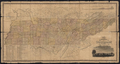
The state of Tennessee is an ever-changing entity, evidenced by the creation and dissolution of counties. Throughout the state’s history, lawmakers renamed some counties, proposed many others that never formed, and created some that they later abolished. James County is the most recognized of these “lost counties” of Tennessee. Established in 1871, James County existed for 48 years until a referendum dissolved it in 1920. 

Excerpt of Agricultural and geological map of Tennessee taken from the 1877 publication “Tennessee: Its Agricultural and Mineral Wealth” by Joseph B. Killebrew, the first Tennessee Commissioner of Agriculture. Click on the link to view the full map in TeVA: http://teva.contentdm.oclc.org/cdm/singleitem/collection/p15138coll23/id/179/rec/1


Tennessee’s second state constitution of 1835 established guidelines for the creation of new counties in Tennessee. Following the enactment of a third state constitution in 1870, lawmakers made several changes affecting the procedure for establishing counties, including a reduction in the size threshold of each county, and an increase in the population threshold. The new regulations included:

  • New counties had to be at least 275 square miles.
  • Their populations had to be at least 700.
  • No part of a new county could be less than 11 miles from adjacent county seat, with exceptions.
  • Existing counties could not be reduced to less than 500 square miles, with exceptions.
  • Two-thirds of the qualified voters within the proposed area of a new county had to agree to its formation.


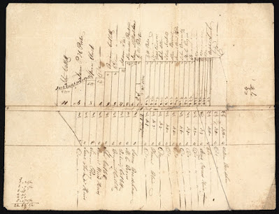
An Act to establish the county of James from parts of Hamilton and Bradley, 1871.
Tennessee State Library & Archives

Predominately white, rural, and poor, James County arose out of the political factionalism of the Reconstruction Era. In 1871, Representative Elbert A. James, a Democrat from Hamilton County, introduced legislation for the formation of the county, named in honor of his father, Rev. Jesse J. James. The elder James, a Methodist minister from Sullivan County, first moved to Chattanooga in the 1850s. Three days after Rep. James introduced his bill, the Tennessee General Assembly passed the act creating James County on Jan. 30, 1871. Lawmakers chose Ooltewah as the county seat, and subsequently citizens began work on building a county courthouse. Following 19 years of meager existence, state lawmakers passed an act on March 11, 1890 abolishing the county and returning the land to the parent counties of Hamilton and Bradley. The legislation specifically mentioned the indebtedness of the county government as the reason for the return to the old boundaries.


An Act to abolish the county of James and restore the territory to the counties of Bradley and Hamilton, enacted March 11, 1890.
Tennessee State Library & Archives


The commissioners of James County, upset with the General Assembly’s actions, filed legal action against the abolition. In James County v. Hamilton County and Bradley County, they argued that the state legislature did not have the power to abolish a county without consent of the qualified voters of the county, and that the “radical legislation” should be overturned. The case made it to the Tennessee Supreme Court where Justice Peter Turney, future Governor of Tennessee, argued that Article X, Section 4 of the new (1870) State Constitution outlined that the “only authority conferred is to build up, and not pull down. It is equally apparent that it never occurred to the framers that a county could be destroyed or dissolved by an arbitrary Act of the Legislature.” He concludes with, “To abolish a county and give its territory to others, is to take from the one and add to the others without the consent of the people to be affected… The act is void.” Turney’s argument was that since the Tennessee Constitution of 1870 didn’t specifically outline the dissolution process for a county that the ultimate power resided with the citizens rather than the legislature.

James County v. Hamilton County and Bradley County, from the Tennessee State Supreme Court Records.


With the Supreme Court ruling, James County survived for another 29 years. However, low tax revenues and a crumbling education system forced the General Assembly to reconsider the county’s existence once more. On April 15, 1919, lawmakers passed an act abolishing James County, pending approval of its citizenry. The fate of James County rested with the voting populace, with a referendum determining the matter scheduled for Dec. 11, 1919.

An Act to abolish the county of James and restore the territory to the counties of Bradley and Hamilton, enacted April 15, 1919.
Tennessee State Library & Archives


The Chattanooga News article from December 10, 1919, the day before the annexation referendum.
Tennessee State Library & Archives


Chattanooga newspapers published the unofficial results of the voting on December 12, 1919. The Chattanooga News reported 941 votes in favor of abolition and 77 against. Three days later, local election commissioners reported the official results to the Tennessee Secretary of State, Ike Stevens, recording 953 votes for abolishment, and 78 against. In the final tally, “more than two-thirds of the qualified voters in James County voted in favor of the abolishment of the county.”

Letter reporting the official December 11th referendum results to the Tennessee Secretary of State, RG 87, Election Returns (State, County, & Local), 1796-present.
Tennessee State Library & Archives


With this vote, James County ceased to exist. After 48 years, the counties of Hamilton and Bradley absorbed James County and its government on January 5, 1920. The plight of James County, perhaps more than any other county in Tennessee, proved how important the formation of counties is to understanding Tennessee history. Marriage, birth, and death records from the period, as well as World War I records, all show James County, yet without knowing its history, researchers can become confused. Thankfully, some of James County’s records have survived various fires, and are presently kept by Hamilton County. The Tennessee State Library & Archives also holds the microfilm copies of James County records, available for use by scholars, genealogists, and researchers.

Photograph of the James County Courthouse in Ooltewah.
Tennessee State Library & Archives


Visit "Maps at the Tennessee State Library and Archives" online at http://share.tn.gov/tsla/TeVAsites/MapCollection/index.htm to learn more.

The Tennessee State Library and Archives is a division of the Tennessee Department of State and Tre Hargett, Secretary of State

Monday, February 22, 2016

Lost Counties... Bell County, Tennessee

The State of Tennessee is an ever-changing entity, evidenced by the creation and dissolution of counties throughout the state’s history. Some counties were renamed, many were proposed but never formed, and some were created and later abolished. These are sometimes known as Tennessee’s “lost counties.” James County is a famous example in East Tennessee, established in 1871, from parts of Hamilton and Bradley counties, it existed for 49 years until a referendum dissolved it in 1920.

A map of the proposed Bell County, Tennessee.


A flurry of new counties were proposed after the State Constitution of 1870, due to the reduction of size and population thresholds for creation. Bell and Nashoba counties, in southwestern Tennessee, were among those that were proposed but never established, while James County was one that actually materialized. Bell County was proposed by an act of the state legislature on December 20, 1870, created from the southern sections of Fayette, Hardeman, and McNairy counties.

An 1870 Public Act of the Tennessee General Assembly that established Bell County.


New counties are established for a variety of reasons; residents often want to have a county seat closer to home, and may also desire more local governance. It is unclear exactly why the citizens of the proposed Bell County wished for their own dominion, but they overwhelmingly did. In the referendum held on February 22, 1871, the citizens voted 1284 to 295 in favor of the new county.

The March 2, 1871 issue of the Somerville Falcon that reported the results of the referendum.


However, the commissioners of the existing counties did not relinquish the land so easily. Running through the middle of the proposed county was the Memphis and Charleston Railroad, which to these rural counties was an important source of tax revenue. At least two court cases were filed to quash the formation of this new county: The Counties of Hardeman and Fayette et al v. J. C. Wells et al; and Thomas H. Cocke et al v. John G. Gooch et al.

The court case, The Counties of Hardeman and Fayette et al v. J. C. Wells et al, attempted to block the creation of Bell County, reached the Tennessee Supreme Court.


The court case, Thomas H. Cocke et al v. John G. Gooch et al, was filed in Fayette County Chancery Court by the county commissioners and, due to issues of constitutionality, reached the Tennessee Supreme Court.


In the latter case, the plaintiffs argued that Bell County was unconstitutionally established, because the number of votes in favor of the new county was not a two-thirds majority of the voting populace, just a two-thirds majority of those who voted. The plaintiffs prevailed with a Supreme Court opinion written by Judge Peter Turney, who later became Governor. Article 4 of the State Constitution at the time defined qualified voters to be “Every male person of the age of twenty-one years, being a citizen of the United States and a resident of this State for twelve months, and of the county for six months…” Casting aside various arguments presented by the defense, Turney decreed “In the case of all laws, it is the intent of the lawgiver that is to be enforced… It is to be presumed that language has been employed with sufficient precision to convey it, and …nothing will remain except to enforce it.” He goes on to say, “The language of the clause is plain and unambiguous…” and that “we can not presume that the framers of the Constitution did not understand the plain and unambiguous expressions employed to mean more or less than their face imparts.”

Thomas H. Cocke et al v. John G. Gooch et al, determined the fate of Bell County. The Tennessee Supreme Court and Justice Peter Turney ruled that the results of the referendum did not constitute a constitutional majority, and therefore Bell County could not be established.


Bell County is a well-documented example of the complex process of county organization. It is important to understand how the state and its counties came into being, and there is no better place to do so than at the Tennessee State Library and Archives.

Visit "Maps at the Tennessee State Library and Archives" online at http://share.tn.gov/tsla/TeVAsites/MapCollection/index.htm to learn more.

Addendum: Nashoba County, seen on the map, faced the same fate as Bell County. It too was legislated into being but never jumped the legal hurdles to establish its existence; in fact it most likely stagnated as a direct result of Bell County’s failure.

An 1871 Public Act of the Tennessee General Assembly that established Nashoba County.


The State Library and Archives is a division of the Tennessee Department of State and Tre Hargett, Secretary of State

Wednesday, February 17, 2016

New Maps Online, Including Tennessee’s “Bell County”

Here's a quick geography quiz: Where in Tennessee would one find Bell County?

The short answer is, "nowhere." But oh, what might have been.

A map of the proposed Bell County, Tennessee.


In 1870, the Tennessee General Assembly proposed a new county along the state's southwestern border, which would have included parts of Fayette, Hardeman and McNairy counties. Residents of what was called Bell County adopted a referendum to secede from the three existing counties, but those counties fought back - perhaps concerned about the loss of the lucrative Memphis and Charleston Railroad line.

The legacy counties prevailed in the Tennessee Supreme Court, successfully arguing that Bell County's residents hadn't met the constitutional voting requirement needed to create a new county.

Although Bell County never officially came to exist, there are nevertheless maps of what it would have looked like. And one of these maps is among the new additions to the Tennessee Virtual Archive.

The Tennessee Virtual Archive, run by the Library and Archives, has hundreds of digitized maps from counties throughout the state, which are accessible to anyone with an Internet connection. These maps are extremely important to historians because they often include details about geographic features such as hollows, ridges and streams as well as human-made structures like roads, schools, churches and even individual homes. In some cases, the maps provide information about who the landowners were at the point in time when the maps were made.

In addition to the rare map of the proposed Bell County, within the last month Library and Archives staff members have added maps from many different Tennessee counties - all of which do exist. These maps show a wealth of detail about long gone landowners, houses, schools and churches.

To learn more about the maps available at the Library and Archives, go to http://sos.tn.gov/tsla and click on the "Maps at the Tennessee State Library and Archives" link under the Online Resources heading.

And stay tuned in the coming days for a more lengthy blog post detailing the history of this long lost county known as Bell County.

The State Library and Archives is a division of the Tennessee Department of State and Tre Hargett, Secretary of State

Monday, July 27, 2015

Two Lectures Highlight TSLA's August Workshop Series

During the month of August, the Tennessee State Library and Archives (TSLA) hosts two lecture events of note:


On Saturday, August 1st from 9:30 a.m. until 11 a.m., TSLA presents Victorian photography expert Lynda Massey for a lecture entitled, "Finding Your Ancestors Through 19th Century Photography." Massey's presentation will focus on Victorian era photography, and how you can identify long lost ancestors through images of period clothing, hair styles, facial hair, and even through details left behind by the photographers themselves.


On Saturday, August 15th from 1:30 p.m. until 3 p.m., in conjunction with the opening of TSLA's historic map collection exhibit, we invite you to attend an engaging lecture by Murray Hudson, owner and proprietor of Antiquarian Books, Maps, Prints, & Globes, as he shares his knowledge about Tennessee cartography. Hudson will explore the history of map making across the entire state of Tennessee, from the early colonial borders, to the "Lost State of Franklin," to Cherokee and Chickasaw territory, and all points in between, in a lecture entitled, "The Evolution of Tennessee's Borders in Maps."

Seats are still available at both lectures. Guests interested in attending these workshop series events are encouraged to register online through Eventbrite, as the number of seats is limited. Parking is available in the front, on the side, and in back of the Library and Archives building. Patrons may register by visiting the following websites:


For more information, please contact TSLA's Public Services at (615) 741-2764 or by email at: workshop.tsla@tn.gov.

The State Library and Archives is a division of the Tennessee Department of State and Tre Hargett, Secretary of State.

Tuesday, July 21, 2015

The Evolution of Tennessee's Borders in Maps

It's easy today to think of Tennessee's borders as set in stone, but that hasn't always been the case. Those borders changed repeatedly throughout the early years of the state's history due to land grant settlements, treaties with Native Americans and even changes in the course of the Mississippi River.

To help better understand how Tennessee's borders came to be where they are, map expert Murray Hudson will conduct a free lecture at the Tennessee State Library and Archives (TSLA) Aug. 15. Hudson, the owner and proprietor of Antiquarian Books, Maps, Prints & Globes in the West Tennessee community of Halls, will take lecture participants on a journey that begins along North Carolina's colonial borders, travels through the “Lost State of Franklin,” documents the annexation of Cherokee and Chickasaw territory, highlights western border changes brought about by shifts in the Mississippi River and describes Supreme Court decisions that seem to have finalized Tennessee's state boundaries.

The lecture will be held from 1:30 p.m. until 3 p.m. Aug. 15 at TSLA's auditorium in downtown Nashville. Although it is free and open to the public, reservations are required because seating in the auditorium is limited. To reserve a spot at the workshop, visit: http://tnmaps.eventbrite.com

The lecture is being conducted to highlight "Find Your Path," a free exhibit of historical maps currently on display in TSLA's lobby. The exhibit will be available for inspection until September during TSLA's normal operating hours, from 8 a.m. until 4:30 p.m. Tuesdays through Saturdays.

Hudson began collecting antique maps during a summer graduate course at Oxford University in England in 1964. After teaching college, trading stocks, manufacturing bicycle trailers and farming, he turned his map collecting passion into a book and map business in 1979. Hudson used worldwide connections to create what are now three galleries of antique books, maps, prints and globes in Halls. Major institutions around the nation and here in Tennessee have his rare books, maps and prints. His galleries house 30,000 antique books, maps and prints, as well as a huge selection of American-made globes and many foreign globes.

TSLA's building is located at 403 Seventh Avenue North, directly west of the State Capitol building in downtown Nashville. Parking is available in the front, on the side, and in back of the building.

The State Library and Archives is a division of the Tennessee Department of State and Tre Hargett, Secretary of State.

Tuesday, May 12, 2015

Free Exhibit Highlights State Library and Archives' Vast Collection of Maps


In the movies, explorers consult well-weathered maps to aid them in their pursuit of hidden treasures. In historical research, though, the maps themselves often are the treasures. Maps provide clues not only about political boundaries and geographic features at various points in history, but also how people actually lived.

Now through Sept. 12, a free exhibit showcasing some of the maps available at the Tennessee State Library and Archives (TSLA) is open in the lobby of TSLA's building in downtown Nashville.

TSLA has thousands of maps in its holdings, many of which are featured in the Tennessee Virtual Archives (TeVA) section of its web pages.To view the TeVA maps online, go to: http://tn.gov/tsla/TeVAsites/MapCollection/index.htm.

"Map of British American Plantations, 1754," possibly TSLA's earliest map of the area that would become Tennessee.
TSLA Map Collection.


TSLA has postal delivery maps so detailed that they include individual homes, churches, schools, stores, mills and cemeteries. TSLA's collections also include soil survey maps that denote minor topographical features such as streams, ridges and hollows.

Just as political boundaries have changed through the years, so, too, have some geographic features. For example, one of the maps on exhibit in TSLA's lobby shows Tennessee in 1822 - just a few years after the New Madrid earthquakes created West Tennessee's Reelfoot Lake.

TSLA also has numerous military maps, including an entire online section dedicated to those from the Civil War. Those maps can be viewed online at: http://tnmap.tn.gov/civilwar/
.
The lobby exhibit includes oversized replicas of maps on display boards, actual maps in display cases and an interactive touchscreen kiosk that allows patrons to explore Civil War sites mapped using Geographic Information System (GIS) technology.

"Sketch of the Battle of Little [Big] Horn, June 25, 1876."
TSLA Map Collection.


"This new exhibit will give visitors to TSLA a small sampling of the vast number of maps that are available there," Secretary of State Tre Hargett said. "I encourage people to check out the exhibit while they're visiting TSLA. Those who can't make it to TSLA's building in downtown Nashville can inspect many of the maps on our website."

The exhibit is available for public viewing during TSLA's normal operating hours, which are from 8 a.m. until 4:30 p.m. Tuesdays through Saturdays.

TSLA's building is located at 403 Seventh Avenue North, directly west of the State Capitol in downtown Nashville. A limited amount of free parking is available around the building.


The State Library and Archives is a division of the Tennessee Department of State and Tre Hargett, Secretary of State.

Tuesday, January 20, 2015

Historic Maps of Tennessee and Beyond: Digital Maps at the Tennessee State Library and Archives

"I need to look at a map to understand it."

How many times have you said that? Tennessee's largest collection of historical maps is ready to be explored at the Tennessee State Library and Archives (TSLA). Maps are invaluable components of historical and genealogical research, and documentary records often cannot be fully understood without referring to maps.

Map of Tennessee (1818), by John Melish and John Strothers, Jr.
Tennessee Virtual Archive (TeVA) Historical Map Collection


In an effort to increase use of this tremendous research resource, TSLA is digitizing original maps and making them available in the Tennessee Virtual Archive (TeVA). An initial collection of more than 100 maps has just been released, and TSLA will continue adding its maps to this digital online collection to bring more of them to a wider public.


Davidson County, Tennessee soil map (1903), by Julius Bien & Co.
Tennessee Virtual Archive (TeVA) Historical Map Collection


On Tuesday, Jan. 27, the State Library and Archives and the Nashville Public Library will host a presentation on the collection, "Historic Maps of Tennessee and Beyond: Digital Maps at the Tennessee State Library and Archives." Dr. Wayne Moore, assistant state archivist, will lead the discussion.


Route of the Memphis-Nashville-Bristol highway (1911).
Tennessee Virtual Archive (TeVA) Historical Map Collection

The presentation is free and open to the public and will begin at 11 a.m. in the auditorium of the Nashville Public Library, 615 Church Street in downtown Nashville.


Map of the British American Plantations (1754)
Tennessee Virtual Archive (TeVA) Historical Map Collection


Visit the Historical Map Collection on TeVA's website at http://tn.gov/tsla/TeVAsites/MapCollection/index.htm to view more digital copies of maps at the Tennessee State Library and Archives.


The State Library and Archives is a division of the Tennessee Department of State and Tre Hargett, Secretary of State.