Public Tags
Showing latest 50 of 69,499 images tagged with subject:Path tag.
|
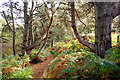
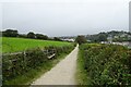
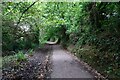
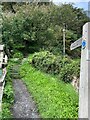
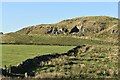
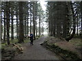
Looking down the South Sutor path
by Julian Paren geograph for square NH8067 This is the start of the path when descending from the hilltop. The path is a... (more)
|
|
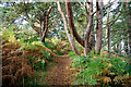
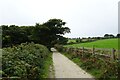
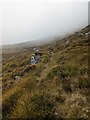
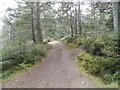
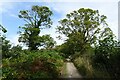
Approaching the top of the South Sutor Path
by Julian Paren geograph for square NH8067 Two fine Scots Pine stand each side of the path. The path is part of the... (more)
|
|
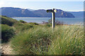
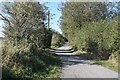
Wales Coast Path north of Deganwy
by Stephen McKay geograph for square SH7780 The path makes its way across the dunes beside the North Wales Golf Course above... (more)
|
|
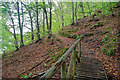
Terrace on the South Sutor, Cromarty
by Julian Paren geograph for square NH8067 The 100 steps path that climbs the South Sutor has a level section after the... (more)
|
|
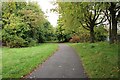
Bench along the path to Swanpool
by DS Pugh geograph for square SW8030 Part of the coast path beside Falmouth Golf Club.
|
|
Coast path south of Swanpool
by DS Pugh geograph for square SW8030 Part of the coast path beside Falmouth Golf Club.
|
|
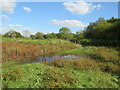
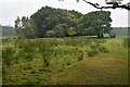
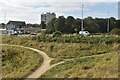
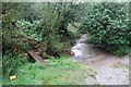
Watrlogged path, Stour Valley Nature Reserve, near Bournemouth
by Malc McDonald geograph for square SZ0896 In southern England, September 2024 was much wetter than average. This image... (more)
Tags:
near:BournemouthX
county:DorsetX
type:GeographX
Nature ReserveX
PathX
subject:Path
Path in Nature ReserveX
top:PathsX
WaterloggedX
Waterlogged PathX
|
|
Stour Valley Way near Bournemouth
by Malc McDonald geograph for square SZ0896 A view of the Stour Valley Way as it passes through the Stour Valley Nature... (more)
Tags:
BenchX
Bench SeatX
near:BournemouthX
county:DorsetX
type:GeographX
Nature ReserveX
subject:Path
Path Along River BankX
Path in Nature ReserveX
top:PathsX
river:River StourX
top:Rivers, Streams, DrainageX
Riverside PathX
river:StourX
Stour Valley WayX
ldp:Stour Valley WayX
long distance path:Stour Valley WayX
river:Stour(Dorset)X
SwansX
|
|
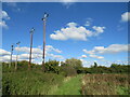
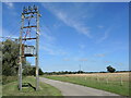
Path in the Stour Valley Nature Reserve near Bournemouth
by Malc McDonald geograph for square SZ0896 Wooden pylons stand tall overlooking a path in the Stour Valley Nature Reserve... (more)
Tags:
near:BournemouthX
county:DorsetX
Electricity PylonX
Electricity PylonsX
top:Energy InfrastructureX
type:GeographX
Nature ReserveX
subject:Path
PathX
Path in Nature ReserveX
top:PathsX
Power PylonX
Power PylonsX
PylonX
PylonsX
Wooden Electricity PylonX
Wooden Electricity Transmission PylonX
Wooden Electricity Transmission PylonsX
Wooden PylonsX
|
|
Short boardwalk on the South Sutor path
by Julian Paren geograph for square NH8067 This well-known path up the South Sutor of Cromarty is nicknamed "The 100... (more)
|

|
Jawbone Walk
by Ian Dodds geograph for square NT2572 This is one of several straight tarmacked paths that cross The Meadows in... (more)
|
|
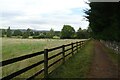
Path beside Brookfield Allotments
by DS Pugh geograph for square SE2136 There is a network of paths around the allotments and recreation ground.
|
|
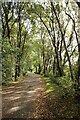
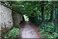
Cycle path to Kirkstall Forge
by DS Pugh geograph for square SE2436 A path through the woods between the railway station and Forge Lock.
|
|
Path through Swanvale Nature Reserve
by DS Pugh geograph for square SW7931 The path heads to Swanpool.
|
|
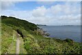
Path at Pendennis Point
by DS Pugh geograph for square SW8231 A path along the east side of the Pendennis headland.
|
|
Path beside Castle Drive
by DS Pugh geograph for square SW8231 A path leading down to some of the shore on the headland in Falmouth.
|
|
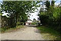
Path towards the River Fowey
by DS Pugh geograph for square SX0963 A path leading down to the river from the house at Lanhydrock.
|
|
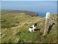
Welsh Coast Path at Amroth
by Eirian Evans geograph for square SN1607 At the western end of the beach, the path climbs up through woodland
Tags:
top:CoastalX
type:GeographX
subject:Path
top:PathsX
top:Village, Rural SettlementX
Wooden SignpostX
top:Woodland, ForestX
|
|
Path on the trackbed of the former Avenue Branch
by David Martin geograph for square NZ3373 |
|
Field path
by Kevin Waterhouse geograph for square SD7615 A path across fields to Hawkshaw Lane heading away from a passage by Bleaklow... (more)
|
|
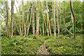
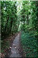
Woodland path near Hale
by Adrian Taylor geograph for square SD5078 This is the public footpath from Fell End to Slack Head.
Tags:
CumbriaX
type:GeographX
HaleX
subject:Path
top:PathsX
Public FootpathX
Public Footpath in WoodlandX
Westmorland and FurnessX
Woodland PathX
top:Woodland, ForestX
|
|
Lùb a' Gharbhrain path
by Callum Black geograph for square NH2775 On the path out from Lùb a' Gharbhrain towards the A835.
|
|
Footpath and cycle path
by Richard Sutcliffe geograph for square NS5068 The joint footpath and cycle path follows the route of an old railway line,... (more)
Tags:
Cycleway and FootpathX
type:GeographX
railway:Lanarkshire and Dunbartonshire RailwayX
subject:Path
top:PathsX
top:RailwaysX
top:Woodland, ForestX
|
|
Footpath and cycle path
by Richard Sutcliffe geograph for square NS5069 The joint footpath and cycle path follows the route of an old railway line,... (more)
Tags:
Cycleway and FootpathX
type:GeographX
railway:Lanarkshire and Dunbartonshire RailwayX
subject:Path
top:PathsX
top:RailwaysX
top:Woodland, ForestX
|
|
Path north of Byerside Wood
by David Martin geograph for square NZ1356 There is a car park here which serves the Derwent Walk and NZ1356 : Derwentcote Steel Furnace, across... (more)
|
|
Path across rough field south of Byerside Wood
by David Martin geograph for square NZ1255 |
|
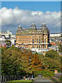
Path towards St Nicholas Cliff, Scarborough
by Paul Harrop geograph for square TA0488 The view is, inevitably, dominated by the imposing mass of the impressive Grand Hotel
|
|
Path to Dunley Wood
by Neil Owen geograph for square ST8482 Leaving the road near Alderton, a public footpath crosses some cattle fields but... (more)
|
|
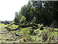
Down over the path
by Neil Owen for square ST8482 The footpath leading south from St Gile's church has had a spot of other. A... (more)
Tags:
Blocked Public FootpathX
type:Cross GridX
Fallen TreeX
subject:Path
top:PathsX
top:Village, Rural SettlementX
|
|
The path of power
by Neil Owen geograph for square ST8483 A footpath for Luckington seems to have some extra company. There are some air... (more)
Tags:
Electricity Transmission PolesX
top:Energy InfrastructureX
FootpathX
type:GeographX
subject:Path
top:PathsX
top:Village, Rural SettlementX
|
|
Paths and road above the Brierdene Burn
by David Martin geograph for square NZ3473 |
|
Field edge path at Brier Dene Farm
by David Martin geograph for square NZ3374 |
|
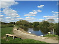
Bletchley Park: Path by the side of the pond
by Michael Garlick geograph for square SP8633 Tags:
type:GeographX
top:Historic Sites and ArtefactsX
top:Lakes, Wetland, BogX
subject:Path
top:PathsX
top:People, EventsX
top:Suburb, Urban FringeX
|
|
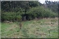
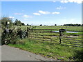
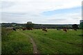
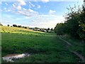
Cattle field beside Rodley Lane
by DS Pugh geograph for square SE2136 Cattle and a path in a field beside the A657.
|
|
Path approaching Brookfield Recreation Ground
by DS Pugh geograph for square SE2136 A footpath between Calverley Lane and Rodley.
|
|
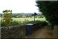
Footpath from Calverley Lane
by DS Pugh geograph for square SE2136 A path viewed from Calverley Lane heading to Rodley.
|
|
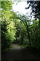
Woodland path
by Graham Hogg geograph for square SK2381 Through unnamed woodland to the east of the village.
|
|
Path towards Bogle Hole
by David Martin geograph for square NY7266 |
|
Waymarked path
by Jonathan Wilkins geograph for square D1842 Following the waymarked path along the edge of the cliffs. From this vantage... (more)
|
|
Footpath from Marlborough Avenue
by DS Pugh geograph for square SW7931 The path heads into Swanvale Nature Reserve.
|
|
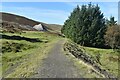
The Trent Valley Way at Gibbet Hill
by Jonathan Clitheroe geograph for square SK6540 Looking towards the northern fringes of Radcliffe on Trent.
|
|
Cnoc Fyrish forest path towards the car park
by Douglas Nelson geograph for square NH6271 |
|
Forest path on Cnoc Fyrish
by Douglas Nelson geograph for square NH6270 |
|
Path in the grounds of Lanhydrock
by DS Pugh geograph for square SX0864 This path heads towards the ticket office and the main house.
|
|
Lady's Walk
by DS Pugh geograph for square SX0963 A path through the woods leading down to the river.
|
|
Flooded bridleway and a bridge
by DS Pugh geograph for square SX0454 Judging by the little notice on the flag, there might have been some... (more)
|
|
Former narrow gauge railway track bed towards Glencrieff Mine
by David Martin geograph for square NS8613 The spoil heap whose summit is just visible here can be seen more fully in... (more)
Tags:
top:Derelict, DisusedX
Former Railway PathX
type:GeographX
top:Historic Sites and ArtefactsX
Lead MiningX
subject:Path
top:PathsX
top:Quarrying, MiningX
top:RailwaysX
top:UplandsX
|
|
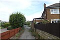
Footpath to West End Grove
by DS Pugh geograph for square SE2238 A footpath from Rawdon Road in Horsforth.
|
|
Bar Lane approaching Rawdon Road
by DS Pugh geograph for square SE2237 Bar Lane is a bridleway running between Calverley Lane in Horsforth Vale and... (more)
|
|
Bar Lane
by DS Pugh geograph for square SE2237 Bar Lane is a bridleway running between Calverley Lane in Horsforth Vale and... (more)
|