Tacheng[2] (Chinese:
Tacheng
Tarbagatay, Chuguchak, Qoqek | |
|---|---|
 "Ruins in Chuguchak" by Vasily Vereshchagin (1869) | |
.png) Location of Tacheng City (pink) in Tacheng Prefecture (yellow) and Xinjiang | |
 Tacheng Location of the city centre in Xinjiang  Tacheng Tacheng (Xinjiang)  Tacheng Tacheng (China) | |
| Coordinates (Tacheng municipal government): 46°45′06″N 82°59′13″E / 46.7517°N 82.9869°E | |
| Country | China |
| Autonomous region | Xinjiang |
| Prefecture | Tacheng |
| Municipal seat | Heping Subdistrict |
| Area | |
| • Total | 3,991.9 km2 (1,541.3 sq mi) |
| Population (2020)[1] | |
| • Total | 158,098 |
| • Density | 40/km2 (100/sq mi) |
| Time zone | UTC+8 (China Standard[a]) |
| Postal code | 834700 |
| Website | www |
| Tacheng | |||||||||||
|---|---|---|---|---|---|---|---|---|---|---|---|
| Chinese name | |||||||||||
| Chinese | |||||||||||
| |||||||||||
| Alternative Chinese name | |||||||||||
| Chinese | |||||||||||
| |||||||||||
| Second alternative Chinese name | |||||||||||
| Chinese | |||||||||||
| |||||||||||
| Third alternative Chinese name | |||||||||||
| Simplified Chinese | |||||||||||
| Traditional Chinese | |||||||||||
| |||||||||||
| Mongolian name | |||||||||||
| Mongolian Cyrillic | Тарвагатай | ||||||||||
| Mongolian script | ᠲᠠᠷᠪᠠᠭᠠᠲᠠᠢ | ||||||||||
| Uyghur name | |||||||||||
| Uyghur | چۆچەك | ||||||||||
| |||||||||||
| Kazakh name | |||||||||||
| Kazakh | شاۋەشەك قالاسى Шәуешек қаласы Şäueşek qalasy | ||||||||||
| Daur name | |||||||||||
| Daur | Тарбгьти Tarbgti | ||||||||||
History
editIn the mid-19th century, Chuguchak was considered the most important commercial center of Western China after Ghulja (Yining), being an important center of trade between China and Russia, in particular in tea. The city, surrounded by an earth wall, was the residence of two Qing ambans and had a garrison of some 1,000 Chinese soldiers and 1,500 Manchu and Mongol soldiers.[3]
Chuguchak suffered harshly in 1865 during the fighting between the Qing forces and the Dungan and Hui rebels.
Tacheng is the site of an internment camp for Turkic Muslims such as the Uyghurs and Kazakhs; it is one of many such camps in Xinjiang. The Chinese government maintains that they are "vocational education centers" for citizens to learn trade skills and the Chinese language, and that the camp was shut down in 2019. However, satellite imagery shows that the camp expanded five-fold later that year.[5][6]
Border crossing
editThe Baktu border crossing (simplified Chinese:
-
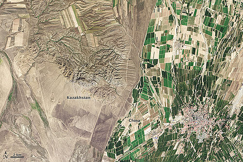 Kazakh-Chinese border near Tacheng

Demographics
edit
Administrative divisions
editTacheng is divided into 3 subdistricts, 2 towns, 3 townships, and 1 ethnic township,
| Name | Simplified Chinese | Hanyu Pinyin | Uyghur (UEY) | Uyghur Latin (ULY) | Kazakh (Arabic script) | Kazakh (Cyrillic script) | Administrative division code | |
|---|---|---|---|---|---|---|---|---|
| Subdistricts | ||||||||
| Heping Subdistrict | Hépíng Jiēdào | تېنچىلىق كوچا باشقارمىسى | tënchiliq kocha bashqarmisi | بەيبىت ءمالى باسقارماسى | Бейбіт мәлі басқармасы | 654201001 | ||
| Dubik Subdistrict | Dùbiékè Jiēdào | دۇبىك كوچا باشقارمىسى | dubik kocha bashqarmisi | دۋبەك ءمالى باسقارماسى | Дубек мәлі басқармасы | 654201002 | ||
| Xincheng Subdistrict | Xīnchéng Jiēdào | يېڭى شەھەر كوچا باشقارمىسى | yëngi sheher kocha bashqarmisi | جاڭا قالا ءمالى باسقارماسى | Жаңа қала мәлі басқармасы | 654201003 | ||
| Towns | ||||||||
| Ergong Town | Èrgōng Zhèn | ئەرگۇڭ بازىرى | Ergung baziri | ارگۇڭ قالاشىعى | Әргүң қалашығы | 654201100 | ||
| Chasha Town | 恰夏镇 | Qiàxià Zhèn | چاشا بازىرى | chasha baziri | شاشا قالاشىعى | Шаша қалашығы | 654201101 | |
| Bozdakh Town | Bózīdákè Zhèn | بوزداق بازىرى | bozdaq baziri | بوزداق قالاشىعى | Боздақ қалашығы | 654201102 | ||
| Townships | ||||||||
| Karakabak Township | 喀拉哈巴 |
Kālāhǎbākè Xiāng | قاراقاباق يېزىسى | qaraqabaq yëzisi | قاراقاباق اۋىلى | Қарақабақ ауылы | 654201200 | |
| Abdira Township | Ābùdūlā Xiāng | ئابدىرا يېزىسى | Abdira yëzisi | ابدىرا اۋىلى | Абдыра ауылы | 654201203 | ||
| Ëmil Township | 也门勒乡 | Yěménlè Xiāng | ئېمىل يېزىسى | Ëmil yëzisi | ەمىل اۋىلى | Еміл ауылы | 654201204 | |
| Ethnic Township | ||||||||
| Axili Daur Ethnic Township | Āxī'ěr Dáwò'ěr Mínzúxiāng | ئاشىلى داغۇر يېزىسى | Ashili daghur yëzisi | اشىلى داعۇر ۇلتتىق اۋىلى | Ашылы Дағұр Ұлттық ауылы | 654201202 | ||
- Others
- Bozdaq Farm (
博 孜 达克农场, بوزداق دېھقانچىلىق مەيدانى, بوزداق اۋىل شارۋاشىلىعى الاڭىنداعى) - Tacheng Prefectural Pasture (
塔 城 地区 种牛场, تارباغاتاي ۋىلايەتلىك چارۋىچىلىق مەيدانى, تارباعاتاي ايماقتىق مال شارۋاشىلىعى الاڭىنداعى) - Woyijiayilao Pasture (窝依
加 依 劳牧场, ئويجايلاۋ چارۋىچىلىق مەيدانى, ۋيجايلاۋ مال شارۋاشىلىعى الاڭىنداعى) - XPCC 164th Regiment (
兵 团一六 四 团, 164-تۇەن مەيدانى, 164-تۋان الاڭىنداعى)
- Bozdaq Farm (
Climate
editTacheng has a typical Xinjiang cool semi-arid climate (Köppen BSk) that is almost moist enough to be a hot summer humid continental climate (Köppen Dfa), as being on the west side of the Altay Mountains the region receives more winter snowfall than most of Xinjiang.
| Climate data for Tacheng, elevation 535 m (1,755 ft), (1991–2020 normals, extremes 1971–2010) | |||||||||||||
|---|---|---|---|---|---|---|---|---|---|---|---|---|---|
| Month | Jan | Feb | Mar | Apr | May | Jun | Jul | Aug | Sep | Oct | Nov | Dec | Year |
| Record high °C (°F) | 8.6 (47.5) |
10.5 (50.9) |
24.7 (76.5) |
33.2 (91.8) |
38.2 (100.8) |
37.6 (99.7) |
40.3 (104.5) |
41.6 (106.9) |
37.7 (99.9) |
32.0 (89.6) |
20.8 (69.4) |
11.8 (53.2) |
41.6 (106.9) |
| Mean daily maximum °C (°F) | −4.0 (24.8) |
−0.8 (30.6) |
7.0 (44.6) |
18.2 (64.8) |
24.2 (75.6) |
29.3 (84.7) |
31.1 (88.0) |
30.2 (86.4) |
24.2 (75.6) |
15.8 (60.4) |
5.2 (41.4) |
−2.1 (28.2) |
14.9 (58.8) |
| Daily mean °C (°F) | −9.9 (14.2) |
−6.8 (19.8) |
0.9 (33.6) |
11.1 (52.0) |
16.8 (62.2) |
21.7 (71.1) |
23.4 (74.1) |
22.2 (72.0) |
16.3 (61.3) |
8.5 (47.3) |
−0.3 (31.5) |
−7.4 (18.7) |
8.0 (46.5) |
| Mean daily minimum °C (°F) | −14.7 (5.5) |
−11.8 (10.8) |
−4.0 (24.8) |
5.2 (41.4) |
10.3 (50.5) |
14.9 (58.8) |
16.8 (62.2) |
15.2 (59.4) |
9.5 (49.1) |
3.0 (37.4) |
−4.5 (23.9) |
−11.6 (11.1) |
2.4 (36.2) |
| Record low °C (°F) | −33.5 (−28.3) |
−37.1 (−34.8) |
−30.6 (−23.1) |
−12.3 (9.9) |
−3.7 (25.3) |
2.6 (36.7) |
6.2 (43.2) |
4.0 (39.2) |
−4.1 (24.6) |
−13.3 (8.1) |
−31.5 (−24.7) |
−34.7 (−30.5) |
−37.1 (−34.8) |
| Average precipitation mm (inches) | 21.6 (0.85) |
17.3 (0.68) |
18.5 (0.73) |
28.8 (1.13) |
29.1 (1.15) |
25.2 (0.99) |
28.0 (1.10) |
20.5 (0.81) |
18.2 (0.72) |
23.1 (0.91) |
38.0 (1.50) |
28.8 (1.13) |
297.1 (11.7) |
| Average precipitation days (≥ 0.1 mm) | 9.7 | 8.2 | 8.2 | 7.8 | 8.2 | 8.5 | 9.0 | 7.1 | 5.2 | 6.9 | 10.1 | 11.0 | 99.9 |
| Average snowy days | 11.4 | 11.1 | 7.3 | 1.3 | 0.2 | 0 | 0 | 0 | 0 | 2.0 | 9.1 | 13.5 | 55.9 |
| Average relative humidity (%) | 70 | 68 | 63 | 51 | 48 | 49 | 51 | 47 | 47 | 57 | 69 | 71 | 58 |
| Mean monthly sunshine hours | 151.7 | 172.4 | 232.1 | 263.4 | 320.2 | 324.7 | 331.7 | 321.3 | 273.3 | 219.1 | 142.7 | 125.5 | 2,878.1 |
| Percent possible sunshine | 53 | 58 | 62 | 64 | 68 | 69 | 70 | 75 | 74 | 67 | 52 | 47 | 63 |
| Source 1: China Meteorological Administration[9][10] | |||||||||||||
| Source 2: Weather China[11] | |||||||||||||
Transportation
editThe Karamay–Tacheng Railway (opened on May 30, 2019) connects Tacheng with Baikouquan Station (
Tacheng is also served by the Tacheng Qianquan Airport with flights to Ürümqi and other cities in Xinjiang.
Notable people
edit- Li Jingliang (born 1988), Chinese mixed martial artist, currently competes in the welterweight in the Ultimate Fighting Championship.
- Zhang Yangyang (born 1991), Chinese pop singer.
Notes
edit- ^ Locals in Xinjiang frequently observe UTC+6 (Xinjiang Time), 2 hours behind Beijing.
References
editThis article includes a list of general references, but it lacks sufficient corresponding inline citations. (September 2016) |
Citations
edit- ^ Xinjiang: Prefectures, Cities, Districts and Counties
- ^ The official spelling according to
中国 地名 录. Beijing: SinoMaps Press (中国 地 图出版 社 ). 1997. ISBN 7-5031-1718-4. - ^ a b Lumley, John (1869), Report by Mr. Lumley, Her Majesty's Secretary of Embassy at St. Petersburgh, on the Tea Trade of Russia, dated May 4, 1867. [Extracted from "Commercial reports" presented to Parliament, July 1867.], p. 73
- ^ Kraus, Charles (June 2019). "Laying Blame for Flight and Fight: Sino-Soviet Relations and the 'Yi–Ta' Incident in Xinjiang, 1962". The China Quarterly. 238: 504. doi:10.1017/S0305741018001789. ISSN 0305-7410.
- ^ "Inside Xinjiang's Prison State". The New Yorker. 26 February 2021.
- ^ Buschek, Megha Rajagopalan, Alison Killing, Christo (27 August 2020). "China Secretly Built A Vast New Infrastructure To Imprison Muslims". BuzzFeed News.
{{cite news}}: CS1 maint: multiple names: authors list (link) - ^ a b
百 年 口 岸 ——巴 克 图-塔 城市 政府 门户网 (in Chinese (China)). Tacheng People's Government. 2011-07-20. Retrieved 2020-05-11. - ^ 3-7
各地 、州 、市 、县(市 )分 民族 人口 数 [3-7 Population by Nationality by Prefecture, State, City and County (City)]. tjj.xinjiang.gov.cn (in Chinese). Statistical Bureau of Xinjiang Uyghur Autonomous Region. 2020-06-10. Archived from the original on 2020-11-01. Retrieved 2021-06-11. - ^
中国 气象数 据 网 – WeatherBk Data (in Simplified Chinese). China Meteorological Administration. Retrieved 10 October 2023. - ^
中国 气象数 据 网 (in Simplified Chinese). China Meteorological Administration. Retrieved 10 October 2023. - ^
塔 城 - 气象数 据 -中国 天 气网 (in Chinese). Weather China. Retrieved 29 November 2022. - ^
穿 越 “魔 鬼 风区”的 克 塔 铁路通 车新 疆实现所有 地 州 首府 通 火 车. Xinhua. 2019-05-30. Archived from the original on May 30, 2019.
Sources
edit- Khālidī, Qurbanʻali, Allen J. Frank, and Mirkasym Abdulakhatovich Usmanov. An Islamic Biographical Dictionary of the Eastern Kazakh Steppe, 1770-1912. Brill's Inner Asian library, v. 12. Leiden: Brill, 2004.
- Light, Nathan. "Qazaqs in the People's Republic of China: The Local Processes of History". Bloomington, Indiana: Indiana Center on Global Change and World Peace, Occasional Paper No. 22, June 1994. ISBN 1-881157-24-5.
- Light, Nathan. "Kazakhs of the Tarbaghatai: Ethno-History Through a Novel". The Turkish Studies Association Bulletin, 17/2 (1993): 91–102.
- Saguchi Toru. "Kazak Pastoralists on the Tarbaghatai Frontier under the Ch'ing." In: Proceedings of the International Conference on China Border Area Studies. Lin En-hsien [Lin Enxian], ed. Taipei: National Chengchi University, 1985, pp. 953–996.
- Wiens, Herold J. "Change in the Ethnography and Land Use of the Ili Valley and Region, Chinese Turkestan". Annals of the Association of American Geographers, Vol. 59, No. 4. (Dec., 1969), pp. 753–775.
External links
edit- Map of the City of Tacheng (in Chinese)
- Webpage on the Bakktu border crossing in Xinjiang's Land Ports and Border Trade website