Cultural Landscape (Japan)
| Part of a series on the |
| Culture of Japan |
|---|
 |
A Cultural Landscape (
Local governments that are in charge of designated Cultural Landscapes can obtain financial assistance from the Agency for Cultural Affairs for surveys and other research, the preparation of preservation plans, maintenance, repair, landscaping, restoration, disaster prevention, and promotional and educational activities.[1][6]
Background[edit]
Research into cultural landscapes began before the Second World War with increasing concern about their disappearance. Historical research into shōen and rural engineering, the scientific investigation of geographic features, and studies for urban and countryside planning have since increased. The movement to protect cultural landscapes has also been influenced by the Law Concerning Special Measures for the Preservation of Historical Natural Features in Ancient Cities (1966), the international trend for recognising "cultural landscapes" under the World Heritage Convention, the designation in 1980 of Mount Hakusan, Mount Ōdaigahara & Mount Ōmine, Shiga Highland and Yakushima as UNESCO Man and the Biosphere Reserves, the designation of Monuments of Japan, and initiatives such as the 100 selected terraced rice fields of Japan.[7][8] From 2000 to 2003 a study was made to define the concept of "cultural landscape" and identify their distribution, with 2,311 areas identified in the first phase and 502 selected for the second, 180 being of particular importance.[9]
Selection criteria of Important Cultural Landscapes[edit]
Important Cultural Landscapes are designated based on their type as:[1][10]
- single-type Cultural Landscapes associated with
- agriculture such as rice paddies, farmlands, etc.
- man-made grassland or livestock ranching such as hayfields, pastureland, etc.
- forests such as timber forests, disaster prevention forests, etc.
- fisheries such as fish cultivation rafts, nori seaweed cultivation fields, etc.
- water uses such as reservoirs, waterways, harbors, etc.
- mining or industrial manufacture such as mines, quarries, groups of workshops, etc.
- transportation and communication such as roads, plazas, etc.
- residences and settlements such as stonewalls, hedges, coppices attached to premises, etc.
- a combination of two or more of the above cultural landscapes.
List of Important Cultural Landscapes[edit]
Usage[edit]
An overview of what is included in the table and the manner of sorting is as follows: the columns (with the exceptions of Remarks and Pictures) are sortable by pressing the arrows symbols.
- Name: the English name as used by the Agency for Cultural Affairs[6] and Japanese name as registered in the Database of National Cultural Properties[2]
- Criteria: the selection criteria for the designation as Important Cultural Landscape
- Remarks: general remarks
- Location: "town-name prefecture-name"; The column entries sort as "prefecture-name town-name".
- Year: year of designation as Important Cultural Landscape
- Picture: picture of (part of) the Important Cultural Landscape
List[edit]
| Name | Criteria | Remarks | Location | Year | Picture |
|---|---|---|---|---|---|
| Cultural Landscape along the Sarugawa River resulting from Ainu Tradition and Modern Settlement (アイヌの |
2 | Litigation over the Nibutani Dam saw the advocacy of Ainu rights in a landmark case (1997).[12] | Biratori, Hokkaidō | 2007 | 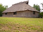
|
| Farm Village of Hondera area, Ichinoseki ( |
1.1, 1.8, 2 | Administered from the late Heian period to the early Muromachi period as the domain of the Sutra Repository Steward of Chuson-ji;[14] in the Edo period it formed part of the Sendai domain.[15] | Ichinoseki, Iwate | 2006 | 
|
| Tono Arakawa Heights Livestock Farm and Tsuchibuchi Yamaguchi Village ( |
1.2 | Important historic pasture.[17] | Tōno, Iwate | 2008/9 | |
| Landscape of Movements of Goods and People in Mogami River and the Aterazawa Townscape ( |
1.5, 1.7, 1.8, 2 | Ōe, Yamagata | 2013 | 
| |
| Fluvial landscape at the confluence of the Tone and Watarase Rivers ( |
1.1, 1.8, 2 | Itakura, Gunma | 2011 | 
| |
| Landscape of the rural villages where gold mining originated in Nishimikawa, Sado ( |
1.1, 1.5, 1.6, 1.8, 2 | Sado, Niigata | 2011 | ||
| Cultural Landscape of the Mining and Mining Town in Aikawa, Sado ( |
1.8, 1.9, 1.10, 2 | Sado, Niigata | 2015 | ||
| Cultural landscape in Kanazawa. Tradition and culture in the castle town ( |
1.5, 1.7, 1.8 | Kanazawa is a renowned centre of Japanese crafts.[25] | Kanazawa, Ishikawa | 2010 | 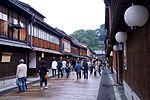
|
| Magaki (bamboo Fence) Village Landscape of Ōzawa and Kami Ōzawa ( |
1.1, 1.10, 2 | Wajima, Ishikawa | 2015 | 
| |
| Rice terraces in Obasute ( |
1.1 | Chikuma, Nagano | 2010 | 
| |
| Cultural Landscape of Kosuge Village and Mt. Kosuge ( |
1.3, 1.5, 1.8, 2 | Iiyama, Nagano | 2015 | 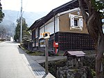
| |
| Cultural Landscape of Gifu in the Central Basin of the Nagara River ( |
1.3, 1.4, 1.7, 1.8, 2 | Gifu, Gifu | 2014 | 
| |
| Wetland in Ōmi-hachiman ( |
1.5, 1.8 | Riverside district of the former castle town.[34] | Ōmihachiman, Shiga | 2006 | 
|
| Waterfront of Kaizu, Nishihama, and Chinai in Takashima City ( |
1.5, 1.7 | Takashima, Shiga | 2008 | 
| |
| Waterfront of Harie and Shimofuri in Takashima City ( |
1.5, 1.8, 2 | Takashima, Shiga | 2010 | 
| |
| Lakeshore landscape at Sugaura ( |
1.1, 1.3, 1.7, 1.8, 2 | Nagahama, Shiga | 2014 | 
| |
| Mountain Village landscape of Higashi Kusano ( |
1.5, 1.7, 1.8, 2 | Maibara, Shiga | 2014 | 
| |
| Ōmizo Lakeside Landscape ( |
1.5, 1.7, 1.8, 2 | Takashima, Shiga | 2015 | 
| |
| Cultural landscape in Uji ( |
2 | Uji, Kyoto | 2009 | 
| |
| Cultural landscape of Miyazu Amanohashidate ( |
1.4, 1.7, 1.8, 2 | Miyazu, Kyoto | 2014 | 
| |
| Cultural Landscape of Okazaki in Kyoto ( |
1.5, 1.7, 2 | Kyoto, Kyoto | 2015 | 
| |
| Rural landscape of Hinenosho Ōgi ( |
1.1, 1.8, 2 | Izumisano, Osaka | 2013 | 
| |
| Cultural landscape of Ikuno mine and townscape ( |
1.6, 1.7, 1.8, 2 | Asago, Hyōgo | 2014 | 
| |
| Cultural landscape of the Asuka hinterland ( |
1.1, 1.5, 1.8, 2 | Asuka, Nara | 2011 | 
| |
| Aragijima Rice Terraces and Rural Mountain Village Landscape of Mita/Shimizu ( |
1.1, 1.8, 2 | Aridagawa, Wakayama | 2013 | 
| |
| Cultural landscape of Tatara iron manufacturing and rice terraces in Okuizumo ( |
1.1, 1.2, 1.5, 1.6, 1.8, 2 | Okuizumo, Shimane | 2014 | ||
| Rice Terraces and Rural Landscape of Kashihara ( |
1.1, 1.8, 2 | Kamikatsu, Tokushima | 2010 | 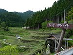
| |
| Danbata (terraced fields) in Yusumizugaura ( |
1.1 | Uwajima, Ehime | 2007 | ||
| Okuuchi rice terraces, agricultural and mountainous village landscape ( |
1.1 | Matsuno, Ehime | 2017 | ||
| Kure port and fishing townscape ( |
1.4, 1.5 | Tosa, Kōchi | 2011 | 
| |
| Cultural landscape in the Shimantogawa River basin. Villages in the mountains to the headwater region ( |
2 | Tsuno, Kōchi | 2009 | ||
| Cultural landscape in the Shimantogawa River basin. Villages and rice terraces in the mountains at the upstream region ( |
2 | Yusuhara, Kōchi | 2009 | ||
| Cultural landscape in the Shimantogawa River basin. Circulation and traffic among agricultural and mountainous villages at the upstream region ( |
2 | Nakatosa, Kōchi | 2009 | ||
| Cultural landscape in the Shimantogawa River basin. Circulation and traffic among agricultural and mountainous villages at the middlestream region ( |
2 | Shimanto, Kōchi | 2009 | 
| |
| Cultural landscape in the Shimantogawa River basin. Vocations, circulation and traffic in the downstream region ( |
2 | Shimanto, Kōchi | 2009 | 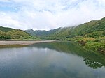
| |
| Rural Landscape of Kubote ( |
1.1, 1.8, 2 | Fukuoka | 2012 | 
| |
| Rice terraces in Warabino ( |
1.1 | located on a north facing horseshoe shaped steep slope of Mount Hachiman ( |
Karatsu, Saga | 2008 | 
|
| Cultural landscape of Hisaka Island, Gotō ( |
1.3, 1.8, 2 | Gotō, Nagasaki | 2011 | 
| |
| Cultural landscape of Kuroshima, Sasebo ( |
1.1, 1.8, 2 | Sasebo, Nagasaki | 2011 | 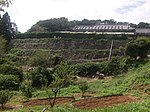
| |
| Cultural landscape of the Ojika islands ( |
1.7, 1.8 | Ojika, Nagasaki | 2011 | 
| |
| Island landscape at Shinkamigoto ( |
1.6, 1.8, 2 | Shinkamigotō, Nagasaki | 2012 | 
| |
| Cultural landscape of Kitauonome, Shinkamigotō ( |
1.2 | Shinkamigotō, Nagasaki | 2012 | 
| |
| Landscape with terraces retained by stonework at Sotome, Nagasaki ( |
1.1, 1.8, 2 | Nagasaki, Nagasaki | 2012 | 
| |
| Cultural landscape in Hirado island ( |
1.1, 1.5, 1.8 | Hirado, Nagasaki | 2010 | 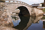
| |
| Landscape with Tsūjun irrigation channel and rice terraces in Shiraito Plateau ( |
1.1, 1.5, 2 | The discharge of water from the Tsūjun Bridge is one of the 100 Soundscapes of Japan | Yamato, Kumamoto | 2008/9 | 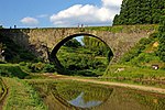
|
| Cultural Landscape of Sakitsu and Imatomi, Amakusa ( |
1.4, 1.7, 1.8 | Amakusa, Kumamoto | 2011 | 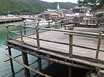
| |
| Cultural landscape of Misumi Bay ( |
1.5, 1.7, 1.8, 2 | Uki, Kumamoto | 2015 | 
| |
| Ontayaki Village ( |
2 | Hita, Ōita | 2008 | 
| |
| Rural landscape of Tashibunoshō Osaki ( |
1.1, 1.8, 2 | Bungotakada, Ōita | 2010 | ||
| Steam and hot spring landscape in Beppu ( |
1.5, 1.6, 2 | Beppu, Ōita | 2012 | 
| |
| Sakamoto Rice Terraces and Rural Mountain Village Landscape of Sakatani ( |
1.1, 1.3, 2 | Nichinan, Miyazaki | 2013 |
See also[edit]
- Cultural landscapes−related topics — international.
- Cultural Landscapes of Australia
- Historic American Landscapes Survey (HALS) — U.S. cultural landscape heritage documentation program.
References[edit]
- ^ a b c "Our Treasure Cultural Landscapes to future generations" (PDF). Administration of Cultural Affairs in Japan ― Fiscal 2009. Agency for Cultural Affairs. 2009. Archived from the original (PDF) on 2010-10-26. Retrieved 2010-01-03.
- ^ a b The Agency for Cultural Affairs (2008-11-01).
国 指定 文化財 データベース (in Japanese). Database of National Cultural Properties. Archived from the original on 2009-03-30. Retrieved 2009-04-16. - ^ "Policy of Cultural Affairs in Japan" (PDF). Agency for Cultural Affairs. 2015. Archived from the original (PDF) on 2016-05-13.
- ^ "
文化 的 景観 " [Cultural Landscapes] (in Japanese). Agency for Cultural Affairs. 2015. - ^ "
重要 文化 的 景観 選定 地 一覧 " [Important Cultural Landscapes Sites] (in Japanese). Nara National Research Institute for Cultural Properties. 2015. - ^ a b "Preservation and Utilization of Cultural Properties - Cultural Landscapes" (PDF). Agency for Cultural Affairs. p. 39. Archived from the original (PDF) on 23 May 2011. Retrieved 18 April 2011.
- ^ "The Report of the Study on the Protection of Cultural Landscapes Associated with Agriculture, Forestry and Fisheries (2003)" (PDF). Agency for Cultural Affairs. pp. 1ff., 33ff. Archived from the original (PDF) on 23 May 2011. Retrieved 29 April 2011.
- ^ "UNESCO MAB Reserves - Asia" (PDF). UNESCO. Retrieved 29 April 2011.
- ^ "The Report of the Study on the Protection of Cultural Landscapes Associated with Agriculture, Forestry and Fisheries (2003)" (PDF). Agency for Cultural Affairs. pp. 21f., 26f., 66ff. Archived from the original (PDF) on 23 May 2011. Retrieved 29 April 2011.
- ^ "The Report of the Study on the Protection of Cultural Landscapes Associated with Agriculture, Forestry and Fisheries (2003)" (PDF). Agency for Cultural Affairs. pp. 25f. Archived from the original (PDF) on 23 May 2011. Retrieved 29 April 2011.
- ^ "Database of Registered National Cultural Properties". Agency for Cultural Affairs. Retrieved 29 April 2011.
- ^ Levin, Mark (1999). "Kayano et al. v. Hokkaido Expropriation Committee: 'The Nibutani Dam Decision' (abstract)". Social Science Research Network. SSRN 1635447.
{{cite web}}: Missing or empty|url=(help) - ^ "Database of Registered National Cultural Properties". Agency for Cultural Affairs. Archived from the original on 5 December 2019. Retrieved 29 April 2011.
- ^ "Honederamura Shoen Iseki". Iwate Prefecture. Archived from the original on 19 July 2011. Retrieved 18 April 2011.
- ^ "Hondera - history". Honederamura. Retrieved 18 April 2011.
- ^ "Database of Registered National Cultural Properties". Agency for Cultural Affairs. Archived from the original on 23 December 2019. Retrieved 29 April 2011.
- ^ "Arakawakōgen bokujō". Iwate Prefecture. Retrieved 29 April 2011.
- ^
大江 町内 の文化財 [Cultural Properties of Ōe town] (in Japanese). Ōe town. Archived from the original on 2014-08-21. Retrieved 2014-08-21. - ^
最上川 の流通 ・往来 及 び左沢 町場 の景観 (PDF) (in Japanese). Yamagata Prefecture. Archived from the original (PDF) on 2014-08-21. Retrieved 2014-08-21. - ^ "Database of Registered National Cultural Properties". Agency for Cultural Affairs. Archived from the original on 23 December 2019. Retrieved 29 April 2011.
- ^ "Database of Registered National Cultural Properties". Agency for Cultural Affairs. Archived from the original on 23 December 2019. Retrieved 29 April 2011.
- ^ "
佐渡 相川 の鉱山 及 び鉱山 町 の文化 的 景観 " [Cultural Landscape of the Mining and Mining Town in Aikawa, Sado] (in Japanese). Sado. Retrieved 27 April 2016. - ^ "
佐渡 相川 の鉱山 及 び鉱山 町 の文化 的 景観 " [Cultural Landscape of the Mining and Mining Town in Aikawa, Sado] (PDF) (in Japanese). Nara National Research Institute for Cultural Properties. Archived from the original (PDF) on 27 April 2016. Retrieved 27 April 2016. - ^ "Database of Registered National Cultural Properties". Agency for Cultural Affairs. Archived from the original on 23 December 2019. Retrieved 29 April 2011.
- ^ "About Kanazawa City". Kanazawa City. Retrieved 29 April 2011.
- ^ "
大沢 ・上大沢 の間 垣 集落 景観 " [Magaki (bamboo Fence) Village Landscape of Ōsawa and Kami Ōsawa] (in Japanese). Ishikawa Prefecture. Retrieved 27 April 2016. - ^ "
大沢 ・上大沢 の間 垣 集落 景観 " [Magaki (bamboo Fence) Village Landscape of Ōsawa and Kami Ōsawa] (PDF) (in Japanese). Nara National Research Institute for Cultural Properties. Archived from the original (PDF) on 27 April 2016. Retrieved 27 April 2016. - ^ "Database of Registered National Cultural Properties". Agency for Cultural Affairs. Archived from the original on 23 December 2019. Retrieved 29 April 2011.
- ^ "
小菅 の里 及 び小菅 山 の文化 的 景観 " [Cultural Landscape of Kosuge Village and Mt. Kosuge] (in Japanese). Iiyama. Retrieved 27 April 2016. - ^ "
小菅 の里 及 び小菅 山 の文化 的 景観 " [Cultural Landscape of Kosuge Village and Mt. Kosuge] (PDF) (in Japanese). Nara National Research Institute for Cultural Properties. Retrieved 27 April 2016.[permanent dead link] - ^ "
長良川 中 流域 における岐阜 の文化 的 景観 " [Cultural Landscape of Gifu in the Central Basin of the Nagara River] (PDF) (in Japanese). Nara National Research Institute for Cultural Properties. Archived from the original (PDF) on 28 April 2016. Retrieved 27 April 2016. - ^ "
長良川 中 流域 における岐阜 の文化 的 景観 " [Cultural Landscape of Gifu in the Central Basin of the Nagara River] (in Japanese). Gifu. Archived from the original on 1 July 2016. Retrieved 27 April 2016. - ^ "Database of Registered National Cultural Properties". Agency for Cultural Affairs. Archived from the original on 23 December 2019. Retrieved 29 April 2011.
- ^ "Omihachiman no suigō". Ōmihachiman. Archived from the original on 19 May 2007. Retrieved 29 April 2011.
- ^ "Database of Registered National Cultural Properties". Agency for Cultural Affairs. Archived from the original on 23 December 2019. Retrieved 29 April 2011.
- ^ "Database of Registered National Cultural Properties". Agency for Cultural Affairs. Archived from the original on 23 December 2019. Retrieved 29 April 2011.
- ^ "
菅浦 の湖岸 集落 景観 保存 活用 計画 報告 書 " (PDF). Nagahama city. Archived from the original (PDF) on 23 September 2015. Retrieved 22 September 2015. - ^ "
東草野 の山村 景観 " [Mountain Village landscape of Higashi Kusano] (PDF) (in Japanese). Nara National Research Institute for Cultural Properties. Archived from the original (PDF) on 27 April 2016. Retrieved 27 April 2016. - ^ "
東草野 の山村 景観 " [Mountain Village landscape of Higashi Kusano] (in Japanese). Maibara. Archived from the original on 3 May 2016. Retrieved 27 April 2016. - ^ "
大 溝 の水辺 景観 " [Ōmizo Lakeside Landscape] (in Japanese). Takashima. Archived from the original on 3 June 2016. Retrieved 27 April 2016. - ^ "
大 溝 の水辺 景観 " [Ōmizo Lakeside Landscape] (PDF) (in Japanese). Nara National Research Institute for Cultural Properties. Archived from the original (PDF) on 27 April 2016. Retrieved 27 April 2016. - ^ "Database of Registered National Cultural Properties". Agency for Cultural Affairs. Archived from the original on 23 December 2019. Retrieved 29 April 2011.
- ^ "
宮津 天橋立 の文化 的 景観 " [Cultural landscape of Miyazu Amanohashidate] (PDF) (in Japanese). Nara National Research Institute for Cultural Properties. Archived from the original (PDF) on 27 April 2016. Retrieved 27 April 2016. - ^ "
宮津 天橋立 の文化 的 景観 " [Cultural landscape of Miyazu Amanohashidate] (in Japanese). Miyazu. Archived from the original on 14 May 2016. Retrieved 27 April 2016. - ^ "
京都 岡崎 の文化 的 景観 " [Cultural Landscape of Okazaki in Kyoto] (in Japanese). Kyoto. Archived from the original on 12 May 2016. Retrieved 27 April 2016. - ^ "
京都 岡崎 の文化 的 景観 " [Cultural Landscape of Okazaki in Kyoto] (PDF) (in Japanese). Nara National Research Institute for Cultural Properties. Archived from the original (PDF) on 27 April 2016. Retrieved 27 April 2016. - ^ "
日 根 荘 大木 の農村 景観 " [Rural landscape of Hinenosho Ōgi] (PDF) (in Japanese). Nara National Research Institute for Cultural Properties. Archived from the original (PDF) on 27 April 2016. Retrieved 27 April 2016. - ^ "
日 根 荘 大木 の農村 景観 " [Rural landscape of Hinenosho Ōgi] (in Japanese). Izumisano. Archived from the original on 3 January 2016. Retrieved 27 April 2016. - ^ "
生野 鉱山 及 び鉱山 町 の文化 的 景観 " [Cultural landscape of Ikuno mine and townscape] (in Japanese). Asago. Archived from the original on 9 May 2016. Retrieved 27 April 2016. - ^ "
生野 鉱山 及 び鉱山 町 の文化 的 景観 " [Cultural landscape of Ikuno mine and townscape] (PDF) (in Japanese). Nara National Research Institute for Cultural Properties. Archived from the original (PDF) on 27 April 2016. Retrieved 27 April 2016. - ^ "Database of Registered National Cultural Properties". Agency for Cultural Affairs. Archived from the original on 23 December 2019. Retrieved 29 April 2011.
- ^ "
蘭島 及 び三田 ・清水 の農 山村 景観 " [Aragijima Rice Terraces and Rural Mountain Village Landscape of Mita/Shimizu] (PDF) (in Japanese). Nara National Research Institute for Cultural Properties. Archived from the original (PDF) on 27 April 2016. Retrieved 27 April 2016. - ^ "
蘭島 及 び三田 ・清水 の農 山村 景観 " [Aragijima Rice Terraces and Rural Mountain Village Landscape of Mita/Shimizu] (in Japanese). Aridagawa. Archived from the original on 27 April 2016. Retrieved 27 April 2016. - ^ "
奥出雲 たたら製鉄 及 び棚田 の文化 的 景観 " [Cultural landscape of Tatara iron manufacturing and rice terraces in Okuizumo] (in Japanese). Okuizumo. Archived from the original on 17 October 2016. Retrieved 27 April 2016. - ^ "
奥出雲 たたら製鉄 及 び棚田 の文化 的 景観 " [Cultural landscape of Tatara iron manufacturing and rice terraces in Okuizumo] (PDF) (in Japanese). Nara National Research Institute for Cultural Properties. Archived from the original (PDF) on 27 April 2016. Retrieved 27 April 2016. - ^ "Database of Registered National Cultural Properties". Agency for Cultural Affairs. Archived from the original on 23 December 2019. Retrieved 29 April 2011.
- ^ "Database of Registered National Cultural Properties". Agency for Cultural Affairs. Archived from the original on 23 December 2019. Retrieved 29 April 2011.
- ^ "
奥内 の棚田 及 び農 山村 景観 " (PDF). Agency for Cultural Affairs. Retrieved 31 May 2017. - ^ "Database of Registered National Cultural Properties". Agency for Cultural Affairs. Archived from the original on 23 December 2019. Retrieved 29 April 2011.
- ^ "Database of Registered National Cultural Properties". Agency for Cultural Affairs. Archived from the original on 23 December 2019. Retrieved 29 April 2011.
- ^ "Database of Registered National Cultural Properties". Agency for Cultural Affairs. Archived from the original on 23 December 2019. Retrieved 29 April 2011.
- ^ "Database of Registered National Cultural Properties". Agency for Cultural Affairs. Archived from the original on 23 December 2019. Retrieved 29 April 2011.
- ^ "Database of Registered National Cultural Properties". Agency for Cultural Affairs. Archived from the original on 23 December 2019. Retrieved 29 April 2011.
- ^ "Database of Registered National Cultural Properties". Agency for Cultural Affairs. Archived from the original on 23 December 2019. Retrieved 29 April 2011.
- ^
求菩提 の農村 景観 [Rural Landscape of Kubote] (in Japanese). Buzen city. Retrieved 2014-08-21. - ^ "Database of Registered National Cultural Properties". Agency for Cultural Affairs. Archived from the original on 23 December 2019. Retrieved 29 April 2011.
- ^ a b "Database of Registered National Cultural Properties". Agency for Cultural Affairs. Archived from the original on 23 December 2019. Retrieved 29 April 2011.
- ^ "Database of Registered National Cultural Properties". Agency for Cultural Affairs. Archived from the original on 5 December 2019. Retrieved 29 April 2011.
- ^
新 上五島 町 崎 浦 の五島 石 集落 景観 [Stone-built Village Landscape of Sakiura, ShinKamigoto] (PDF) (in Japanese). Shinkamigotō. Archived from the original (PDF) on 2014-08-21. Retrieved 2014-08-21. - ^ "Database of Registered National Cultural Properties". Agency for Cultural Affairs. Archived from the original on 23 December 2019. Retrieved 29 April 2011.
- ^ a b "Database of Registered National Cultural Properties". Agency for Cultural Affairs. Archived from the original on 23 December 2019. Retrieved 29 April 2011.
- ^ "Database of Registered National Cultural Properties". Agency for Cultural Affairs. Archived from the original on 23 December 2019. Retrieved 29 April 2011.
- ^ "Database of Registered National Cultural Properties". Agency for Cultural Affairs. Archived from the original on 23 December 2019. Retrieved 29 April 2011.
- ^ "
三角浦 の文化 的 景観 " [Cultural landscape of Misumi Bay] (PDF) (in Japanese). Nara National Research Institute for Cultural Properties. Archived from the original (PDF) on 27 April 2016. Retrieved 27 April 2016. - ^ "Database of Registered National Cultural Properties". Agency for Cultural Affairs. Archived from the original on 23 December 2019. Retrieved 29 April 2011.
- ^ "Database of Registered National Cultural Properties". Agency for Cultural Affairs. Archived from the original on 23 December 2019. Retrieved 29 April 2011.
- ^
別府 の湯 けむり景観 [Hot spring Landscape in Beppu] (in Japanese). Beppu. Archived from the original on 2016-05-13. Retrieved 2016-04-27. - ^ 「
別府 市 景観 条例 」「別府 市 景観 計画 」「別府 市 景観 計画 ガイドライン」について [Beppu landscape regulations, plan, project guidelines] (in Japanese). Beppu. Retrieved 2014-08-21. - ^ "
酒 谷 の坂元 棚田 及 び農 山村 景観 " [Sakamoto Rice Terraces and Rural Mountain Village Landscape of Sakatani] (PDF) (in Japanese). Nara National Research Institute for Cultural Properties. Archived from the original (PDF) on 27 April 2016. Retrieved 27 April 2016. - ^ "
酒 谷 の坂元 棚田 及 び農 山村 景観 " [Sakamoto Rice Terraces and Rural Mountain Village Landscape of Sakatani] (in Japanese). Nichinan. Retrieved 27 April 2016.
Bibliography[edit]
重要 文化 的 景観 選定 地 一覧 [Important Cultural Landscape Sites] (in Japanese). Nara National Research Institute for Cultural Properties. Retrieved 2014-08-21.- Chiang, Yen-Cheng; Weng, Pei-Yi; Sato, Noriko (2013). "The Preservation of Important Rural Japanese Cultural Landscapes – Considering the Warabino Paddy Field as an Example" (PDF). Journal of the Faculty of Agriculture, Kyushu University. 58 (2): 209–218. doi:10.5109/26182. Archived from the original (PDF) on 2016-03-04. Retrieved 2015-10-16.
Further reading[edit]
Nakagoshi, Nobukazu (2011). "How to Conserve Japanese Cultural Landscapes: The Registration System for Cultural Landscapes". In Sun-kee Hong (ed.). Landscape Ecology in Asian Cultures. Springer. pp. 249–276. ISBN 978-4-431-87798-1.
